France Germany Luxembourg Duchy of Lorraine 1708 de la Feuille map 13 city plans
Brian DiMambro- Antiquarian Books, Maps & Prints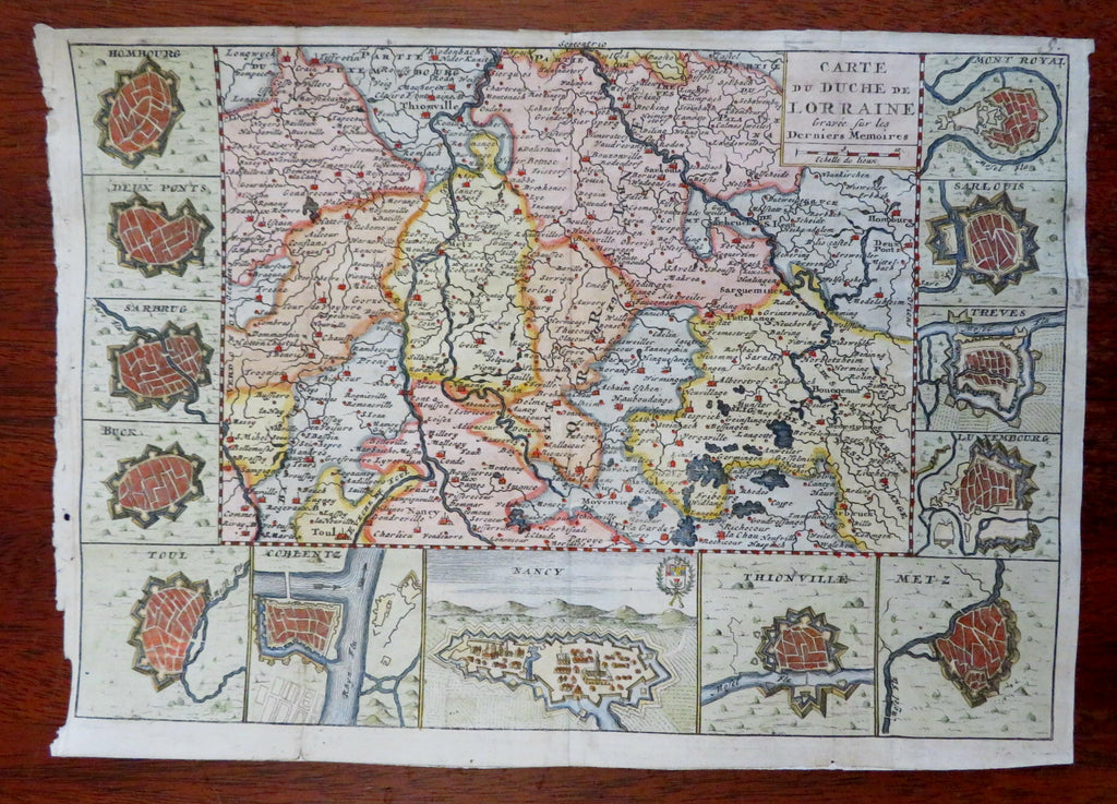
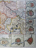
Carte du Duche de Lorraine.
(Old Maps, 18th Century Maps, Europe, France, Lorraine, Nancy, Metz, Koblenz, Luxembourg).
Issued 1708, Amsterdam by de La Feuille.
Scarce early 18th century engraved map with attractive hand color. Thirteen city plans on three sides of map.
Remains a nice looking example with a pleasing age patina, left blank margin edge uneven as seen. Any age flaws mostly minor and easy to overlook or forgive.
Original fold lines as issued, map was neatly affixed long ago to an old paper backing sheet.
Sheet Measures c. 7 3/4" H x 10 1/4" W.
Engraved Area Measures c. 6 1/4" H x 8 1/2" W.
Cartographic Reference(s):
Tooley's Dictionary of Mapmakers, vol. 1.
[B15811].