Hindoostan India from latest authorities 1800 Wilkinson scarce map
Brian DiMambro- Antiquarian Books, Maps & Prints

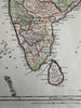
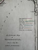
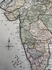
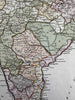
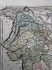
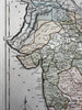
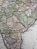
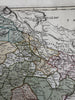
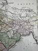
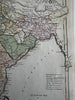
An accurate map of Hindoostan drawn from the latest authorities. (India).
Uncommon late-18th century engraved map with original hand color.
A beautiful map. Color coded key shows British colonial boundaries as well as more local realms.
Clean, fine condition.
Sheet measures c. 10 1/2” x 13 1/8”.
Printed area c. 9 1/2" x 11 1/2".
R36269