Kentucky & Tennessee Government early states 1796 Doolittle rare seminal map
Brian DiMambro- Antiquarian Books, Maps & Prints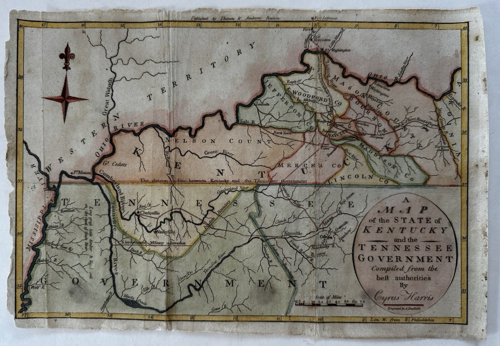
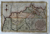
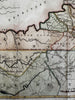
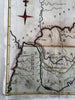
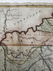

A Map of the state of Kentucky and the Tennessee Government compiled from the best authorities by Cyrus Harris.
Issued 1796, Boston for Morse. Publ. by Thomas & Andrews. Engraved by Amos Doolittle. A seminal historical map.
Original 18th century antique, fully American made, engraved map (paper, engraver, printer & press, creator, etc). This example with very nice and visually superior hand color.
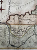
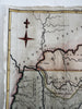
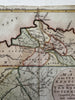
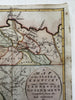
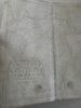
Fair to Good condition, some well done paper repairs on reverse to fold lines. Two main fold lines well age creased (one once separated) and now nicely joined and reinforced on reverse with sturdy archival tissue paper. Near expert level paper restoration work. Small edge chipping along left blank margin and top, paper is lightly aged toned, couple small spots, pics capture map better than words. Not a perfect example but a noble and good looking survival.
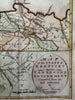
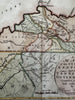
Several well done tissue paper repairs to fold lines along reverse. I try to show these in the pics- they’re skillfully and beautifully done and the map now displays a very nice visual appeal.
Light surface toning or spotting, sheet uniformly lightly toned as seen, narrow left side margin, small old light age spots, signs of having been handled, map actually looks great and displays very well.
All examples of 18th century American maps are inherently uncommon, the entire print run for any specific one could readily have been and probably was in the low thousands total for any specific map, of which a high percentage of each likely no longer survive. The attrition rate of many old paper items is phenomenally high, often in the 90% range or above. All maps of this era including this one inherently uncommon by virtue of date and significance.
This example is completely worthy of framing for display as a rare early map of these states. An early, seminal map, of permanent historical value and interest.
Sheet measures c.8 1/4" x 12".
Engraved area c.7 5/8" x 11 3/8".
R36437
Wheat & Brun, maps published in America before 1800,