Louisiana state w/ New Orleans city plan 1855 Cowperthwait lovely hand color map
Brian DiMambro- Antiquarian Books, Maps & Prints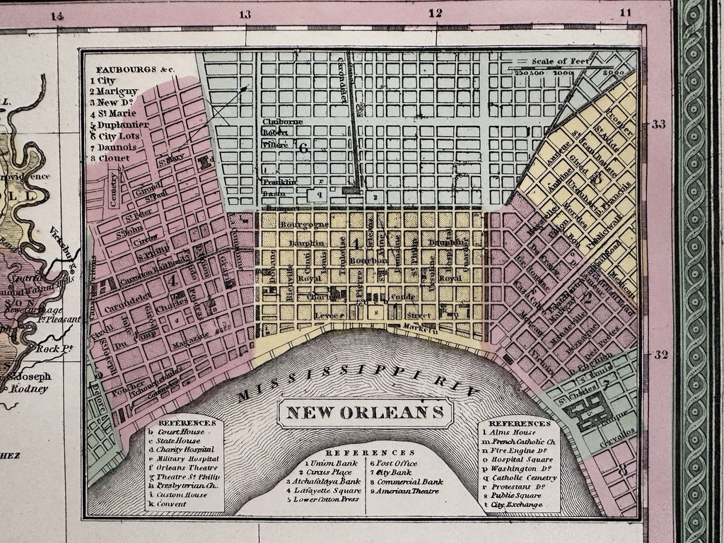
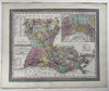


A New Map of Louisiana with its canals, roads & distances from place to place, along the stage & steam boat routes.
Published 1850-55, Phila. by Thomas, Cowperthwait & Co. (This variant issue likely being 1854-5 despite the imprint at bottom stating 1850). There are several variants of this map which all display the same 1850 imprint but were released across years within atlases having later title page dates.
Beautiful mid- 19th century (engraved) lithographed map with original hand color.
With a great detailed inset plan of New Orleans top right which has a Reference key identifying 27 specific locations of note. Early railroad lines shown in color. Key top and lower left show "Steam Boat Routes".
Lovely folio sheet map, perfect for display, gift giving, being part of a collection, etc.
Clean, fresh, near fine condition.
Sheet measures c. 16 7/8” x 13 1/2”.
Printed area c.11 1/2" x 14 3/8".
R36419