Reformation Europe Charles V Holy Roman Empire 1860 Dufour historical map
Brian DiMambro- Antiquarian Books, Maps & Prints
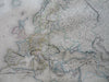
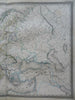
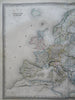
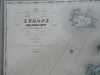
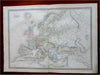
Europe Sous Charles-Quint (XVI Siecle).
(Old Maps, 19th Century Maps, Europe, Historical Maps, Reformation Europe, Holy Roman Empire, Spain, France, England, Scandinavia, Italian States, Ottoman Empire).
Issued 1860, Paris by Armand Le Chevalier. Map by A.H. Dufour. Engraved by Dyonnet.
Oversize mid 19th century engraved map with lovely original hand color. Among the largest commercially produced maps of this era.
Well preserved, nice looking example with pleasing age patina.
Original center fold as issued.
Sheet Measures c. 24" H x 37" W.
Engraved Area Measures c. 22" H x 29 1/2" W.
Cartographic Reference(s):
Tooley's Dictionary of Mapmakers, vol. 1.
[R30471].