Scotland Hebrides islands Ile ca. 1654 Blaeu scarce Atlas Novus folio map
Brian DiMambro- Antiquarian Books, Maps & Prints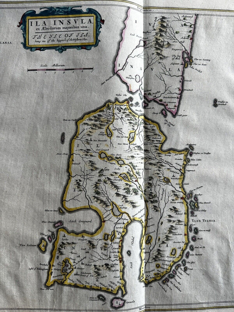
ILA Insula ex Aebudarum majoribus una. The Eyle of ILa being one of the biggest in the Westerne Yles.
Issued ca.1654, Amsterdam by W. Blaeu.
Scotland- Hebrides Islands.
Original mid-17th century copper engraved folio sheet map with original hand color.
Sheet measures c. 20 3/4” H x 24” W.
Nice example, mostly clean.
Appeared late within the atlas production and was printed in a quite small press running 500 or less. Scarce map thus.
R36017