United States territorial west 1854 JH Young Desilver Cowperthwait scarce map
United States territorial west 1854 JH Young Desilver Cowperthwait scarce map United States territorial west 1854 JH Young Desilver Cowperthwait scarce map United States territorial west 1854 JH Young Desilver Cowperthwait scarce map United States territorial west 1854 JH Young Desilver Cowperthwait scarce map United States territorial west 1854 JH Young Desilver Cowperthwait scarce map United States territorial west 1854 JH Young Desilver Cowperthwait scarce map United States territorial west 1854 JH Young Desilver Cowperthwait scarce map United States territorial west 1854 JH Young Desilver Cowperthwait scarce map United States territorial west 1854 JH Young Desilver Cowperthwait scarce map United States territorial west 1854 JH Young Desilver Cowperthwait scarce map United States territorial west 1854 JH Young Desilver Cowperthwait scarce map United States territorial west 1854 JH Young Desilver Cowperthwait scarce map United States territorial west 1854 JH Young Desilver Cowperthwait scarce map United States territorial west 1854 JH Young Desilver Cowperthwait scarce map United States territorial west 1854 JH Young Desilver Cowperthwait scarce map United States territorial west 1854 JH Young Desilver Cowperthwait scarce map United States territorial west 1854 JH Young Desilver Cowperthwait scarce map United States territorial west 1854 JH Young Desilver Cowperthwait scarce map United States territorial west 1854 JH Young Desilver Cowperthwait scarce map United States territorial west 1854 JH Young Desilver Cowperthwait scarce map United States territorial west 1854 JH Young Desilver Cowperthwait scarce map United States territorial west 1854 JH Young Desilver Cowperthwait scarce map United States territorial west 1854 JH Young Desilver Cowperthwait scarce map United States territorial west 1854 JH Young Desilver Cowperthwait scarce map
$ 650.00

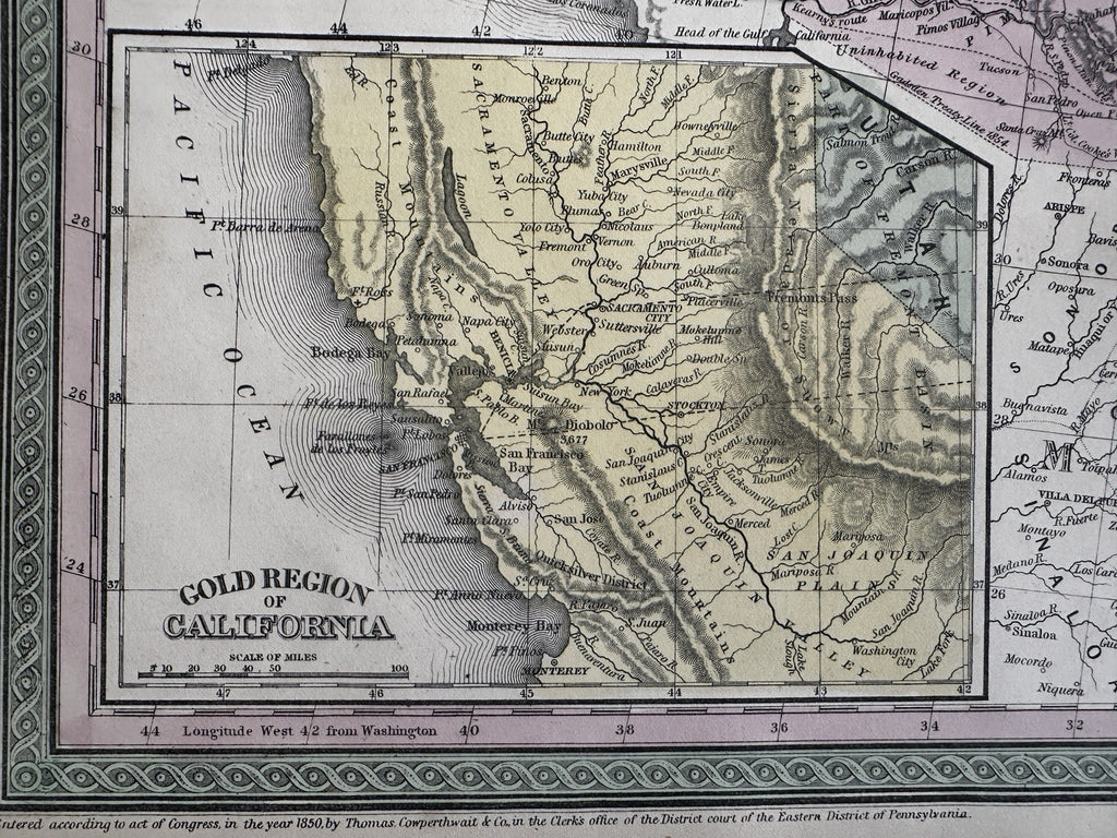
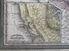
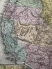
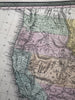
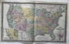
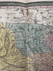
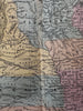
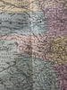
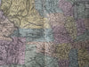
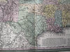
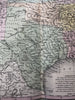
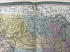
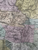
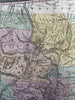
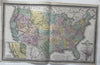
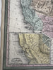
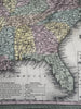
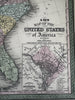
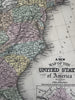
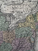
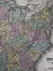
A new map of the United States of America by J. H. Young.

Published 1854-55, Phila. by Thomas, Cowperthwait & Co. (This variant issue likely being 1854-5 despite the imprint at bottom stating 1850).

Beautiful mid- 19th century (engraved) lithographed map with original hand color.

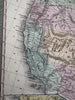
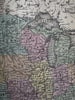
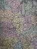
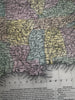
Inset at lower left, focusing on the gold regions of California. A scarce map, which is among the first to show Nebraska territory, as well as Kansas territory. The remaining western states are territorial, including a huge New Mexico, Utah and Oregon. Minnesota is also a large territory.

Lovely folio sheet map, perfect for display, gift giving, being part of a collection, etc.

Clean, fresh, near fine condition.

Sheet measures c. 16 7/8” x 27”.

Printed area c. 15 7/8” x 26 1/4”.

R36430