Virginia state stage coach roads shown RR lines 1855 Cowperthwait lovely map
Brian DiMambro- Antiquarian Books, Maps & Prints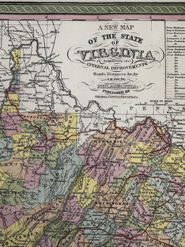


A New Map of the state of Virginia exhibiting its internal improvements, Roads, Distances, etc. By J.H. Young.
Published 1850-55, Phila. by Thomas, Cowperthwait & Co. (This variant issue likely being 1854-5 despite the imprint at bottom stating 1850). There are several variants of this map which all display the same 1850 imprint but were released across years within atlases having later title page dates.
Beautiful mid- 19th century (engraved) lithographed map with original hand color.
Extensive text key top right corner delineating "Principal Rail Roads & Stage Routes through Virginia". Inset top left shows District of Columbia and Washington city, noting the portion of land which had been ceded to Virginia in 1846, thus shrinking it's size by roughly 1/3. includes modern day West Virginia as well, showing the early railroad lines.
Lovely folio sheet map, perfect for display, gift giving, being part of a collection, etc.
Clean, fresh, near fine condition.
Sheet measures c. 16 7/8” x 13 1/2”.
Printed area c.15 5/8" x 12 5/8".
R36415