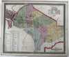
Washington, D.C. city plan names hotels & African churches 1855 Cowperthwait map
Brian DiMambro- Antiquarian Books, Maps & Prints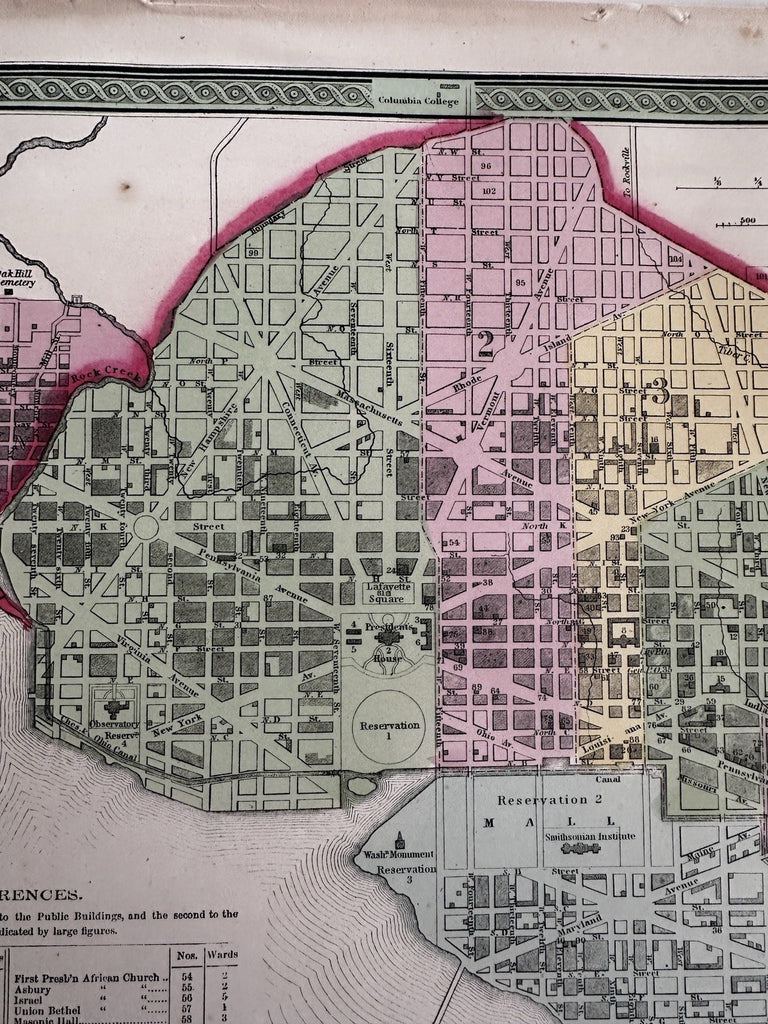
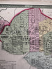
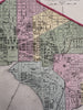
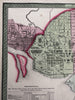

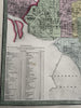
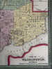
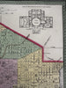
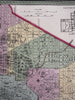
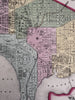
City of Washington.
Published 1850-55, Phila. by Thomas, Cowperthwait & Co. (This variant issue likely being 1854-5 despite the imprint at bottom stating 1850).
Beautiful mid-19th century (engraved) lithographed city plan map with original hand color.
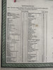
Extensively detailed Reference key lower left in two columns listing dozens of public buildings, many churches including three "African-American" churches (including a First Baptist), two orphanages, banks, hotels, halls, and much more. Top right corner is a cross section floor plan of the Capitol building.
Lovely folio sheet map, perfect for display, gift giving, being part of a collection, etc.
Clean, fresh, near fine condition, a couple small light age spots, nice overall patina.
Sheet measures c. 16 7/8” x 13 1/2”.
Printed area c. 15 5/8" x 12 1/2".
R36426