West Africa Guinea Morocco Sahara Desert Benin 1879 Petermann detailed map
Brian DiMambro- Antiquarian Books, Maps & Prints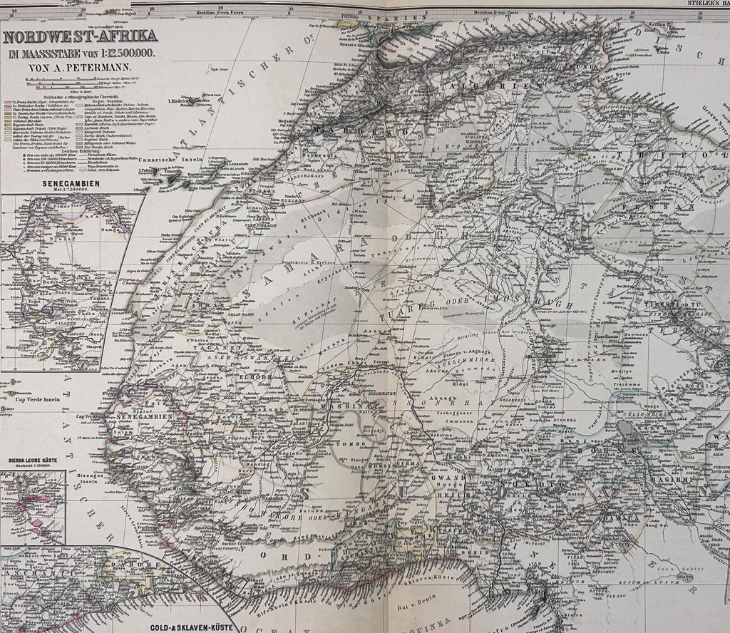
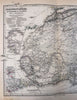
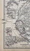
Norwest-Afrika.
(Old Maps, 19th Century Maps, Africa, West Africa, Morocco, Sahara Desert, Atlas Mountains, Guinea, Senegal, Gambia, Niger River, Dahomey, Benin, Ivory Coast, Gold Coast).
Issued 1879 Gotha by Justus Perthes for Stieler. Map by Petermann.
Very detailed 19th century engraved map with original outline hand color.
Stieler maps went through continual revisions. Thus, for any specific Stieler map such as this one, there are often numerous variant issues with varying details.
Nice looking example, blank margins with some old finger soiling from handling, still a pleasing age patina, any minor age flaws easy to overlook or forgive.
Original center fold as issued.
Sheet Measures c. 13 3/4" H x 17" W.
Cartographic Reference(s):
Tooley's Dictionary of Mapmakers, vol. 4.
[R30102].