Western Roman Empire Italy France Spain Britain 1720 Chatelain engraved map
Brian DiMambro- Antiquarian Books, Maps & Prints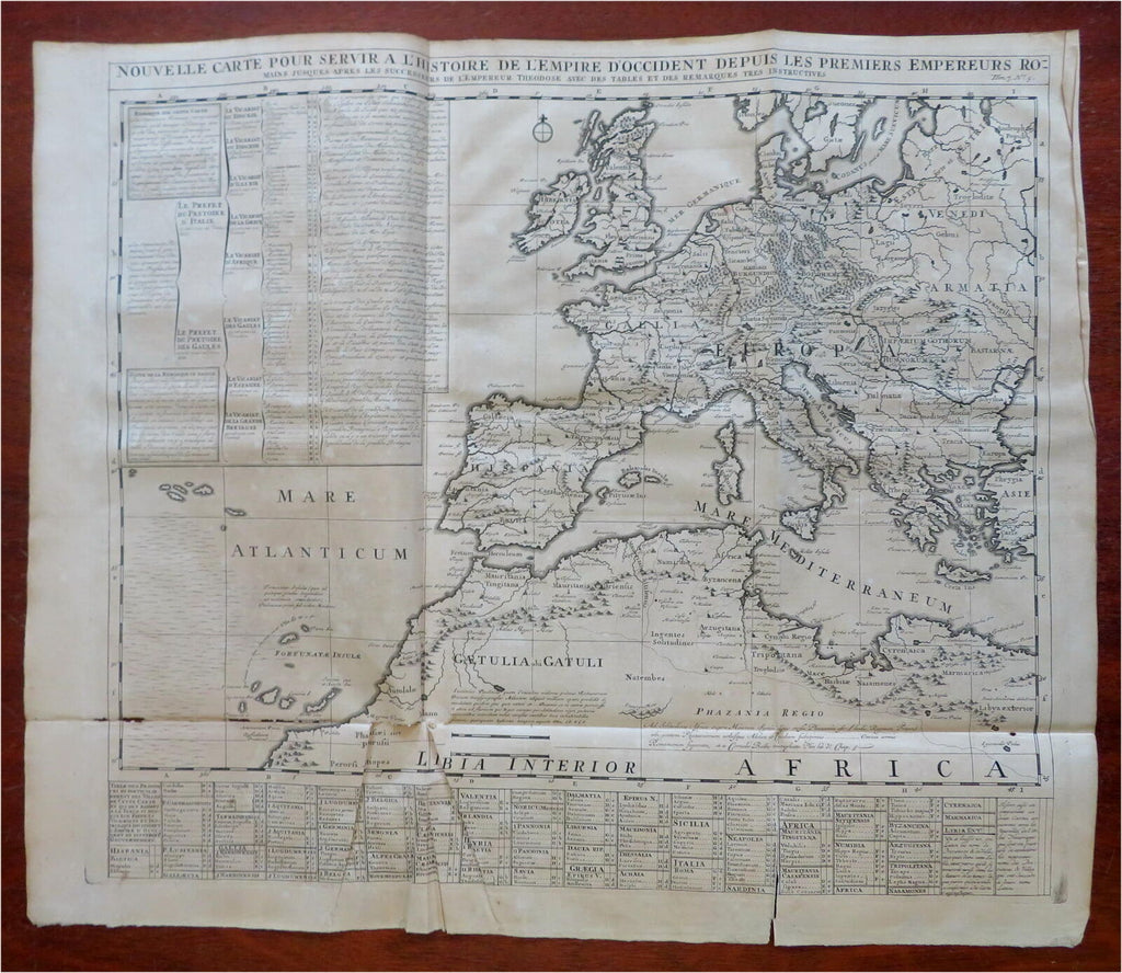
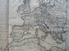

Nouvelle Carte Pour Servir A L'Histoire de L'Empire D'Occident Depuis Les Premier Empereurs Romains Jusques Apres Les Successeurs De L'Emprerur Theodose Aves Des Tables Et Des Remarques Tres Instructives.
(Old Maps, 18th Century Maps, Europe, Ancient World, Roman Empire, Western Roman Empire, Hispania, Gallia, Britannia, Germania, Italia, Dacia, Greece)
Issued 1720, Amsterdam by Chatelain.
Large early 18th century engraved map.
Nice looking example, sheet is well uniformly age toned, pleasing age patina, some splitting along fold lines, some small chew loss along the lower left fold line in the Atlantic area and into Libya, any minor age flaws easy to overlook or forgive. Map could easily be backed in these thin areas of loss .
Original fold lines as issued.
Sheet measures c. 17 3/4" H x 25 3/4" W.
[R28802].