World showing tracks of Cook latest voyages & Travels 1800 Wilkinson scarce map
Brian DiMambro- Antiquarian Books, Maps & Prints

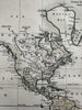
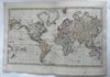
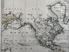
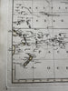

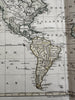
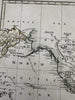
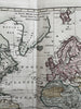
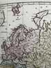

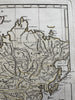


A New Mercator's Chart Drawn from the Latest Discoveries.
Issued London, 1800 by Wilkinson.
Uncommon late-18th century engraved map with original hand color.
A beautiful map. Shows the tracks of Capt. Cook across the oceans.
Clean, fine condition. Original centerfold.
Sheet measures c. 19 1/8” x 13 1/8”.
Printed area c. 17 1/2” x 10 1/2”.
R36280