Asia Qing China Ottoman Arabia British India Russia Japan 1850 Betts Scarce Map
Brian DiMambro- Antiquarian Books, Maps & Prints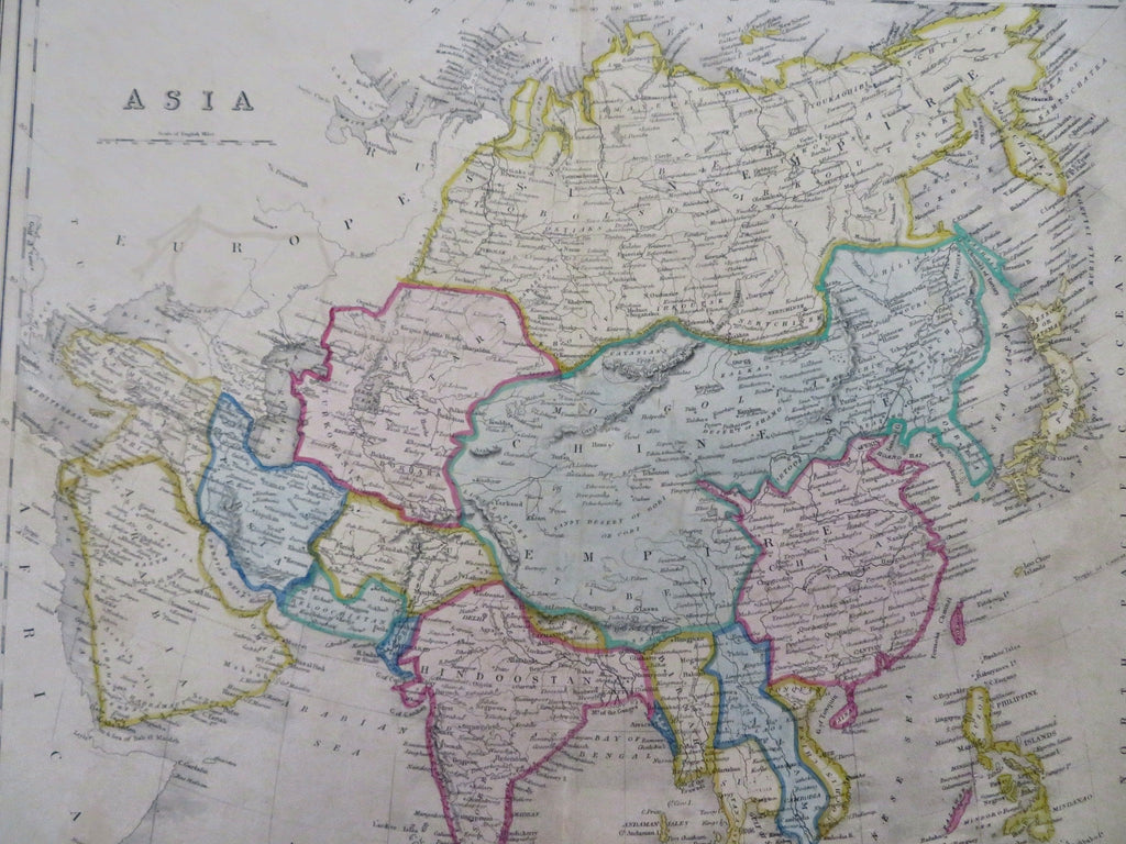

Asia.
(Old Maps, 19th Century Maps, Asia, Ottoman Empire, Arabia, Persia, Iran, Russian Empire, British India, Qing China, Southeast Asia, Japan, Korea, Philippines).
Issued c. 1850-53, London by John Betts for The London Modern Atlas - (flourished 1844-63, 115 Strand).
Scarce, fascinating and decorative mid 19th century antique map.
Lithographed with original hand color. Note the strong decorative lithographed surrounding frame-like border, a feature soon to disappear on maps of the era.
Original centerfold as issued.
Sheet measures c. 14 3/4 " H x 18 1/2 " W.
Printed area measures c. 13 3/8" H x 16 1/8 " W.
[R35757].
Tooley's Dictionary of mapmakers, v. 1, p. 133-noting he worked in London c.1844-63.
Phillips, Atlases in Library of Congress.
From a rare London folio atlas which saw only a very limited distribution at the time, nothing like the major U.K. cartographic publishers of the day.