Brest Brittany France coastal survey 1700 Moll detailed engraved harbor map
Brian DiMambro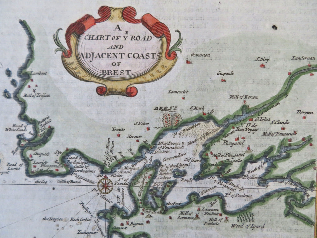
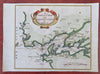
A Chart of Ye Road and Adjacent Coast of Brest.
(Old Maps, 18th Century Maps, Europe, Kingdom of France, Brittany, Brest, Harbor Map, Coastal Survey).
Issued 1700, London by H. Moll.
Charming early 18th century engraved miniature map with beautiful hand color. Text on reverse as issued.
Nice looking example, pleasing age patina, any minor age flaws easy to overlook or forgive.
Sheet measures c. 6 1/4" H x 7 3/4" W.
Engraved area measures c. 5 1/2" H x 6" W.
Cartographic Reference(s):.
Tooley's Dictionary of Mapmakers, vol. 3.
[B12347.