Candie Military Fortifications Haraklion Greece 1760 Bellin detailed city plan
Brian DiMambro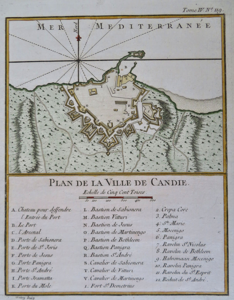

Plan de la Ville de Candie.
(Old Maps, 18th Century Maps, Europe, Greece, Candia, Heraklion, Detailed City Plan, Military Fortifications).
Issued 1760, Paris by Bellin. Engraved by Croidy.
Mid 18th century engraved map with a pleasing, strong impression.
Nice looking example, pleasing age patina, any minor age flaws easy to overlook or forgive.
Sheet measures c. 12 3/4" H x 9 1/4" W.
Engraved area measures c. 9" H x 7 1/4" W.
Cartographic Reference(s):.
Tooley's Dictionary of Mapmakers, vol.1.
[R34144].