District of Maine Pre-Statehood 1802 Gridley map Thompson #9 w/ no York County
Brian DiMambro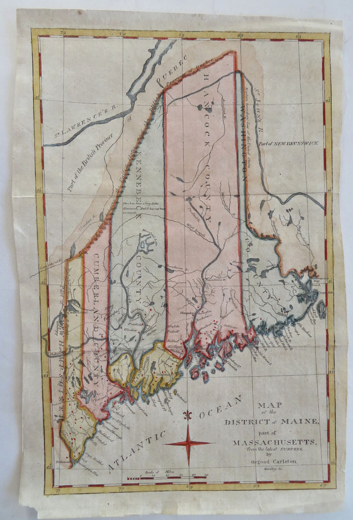
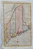
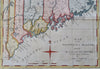
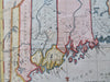
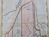
Map of the District of Maine, Part of Massachusetts from the Latest Surveys.
(Old Maps, 19th Century Maps, Americana, United States, New England, Maine, Portland, Kittery, Brunswick, Mt. Desert Island).
Issued 1802, Boston. Map by Osgood Carleton. Engraved by Gridley.
Uncommon early 19th century engraved map with attractive recent hand color. York County in the south is not named. Above Moosehead Lake is a notation "Here has been a large lake discovered but it has not been surveyed.".
Among the earliest maps of Maine a collector can affordably own.
Remains a nice looking example with a pleasing age patina, blank margins are wide but uneven. Any age flaws mostly minor and easy to overlook or forgive.
Original fold lines as issued.
Sheet Measures c. 13" H x 8 1/2" W.
Engraved Area Measures c. 12" H x 7 1/2" W.
Cartographic Reference(s):
Thompson, Printed Maps of Maine, 9 (noting the map apparently appears only in one 1802 Jedidiah Morse gazetteer).
Tooley's Dictionary of Mapmakers, vol. 2.
[R32182].