Germany Bohemia 1761 map Holy Roman Empire United Provinces by Buache & DeLisle
Brian DiMambro- Antiquarian Books, Maps & Prints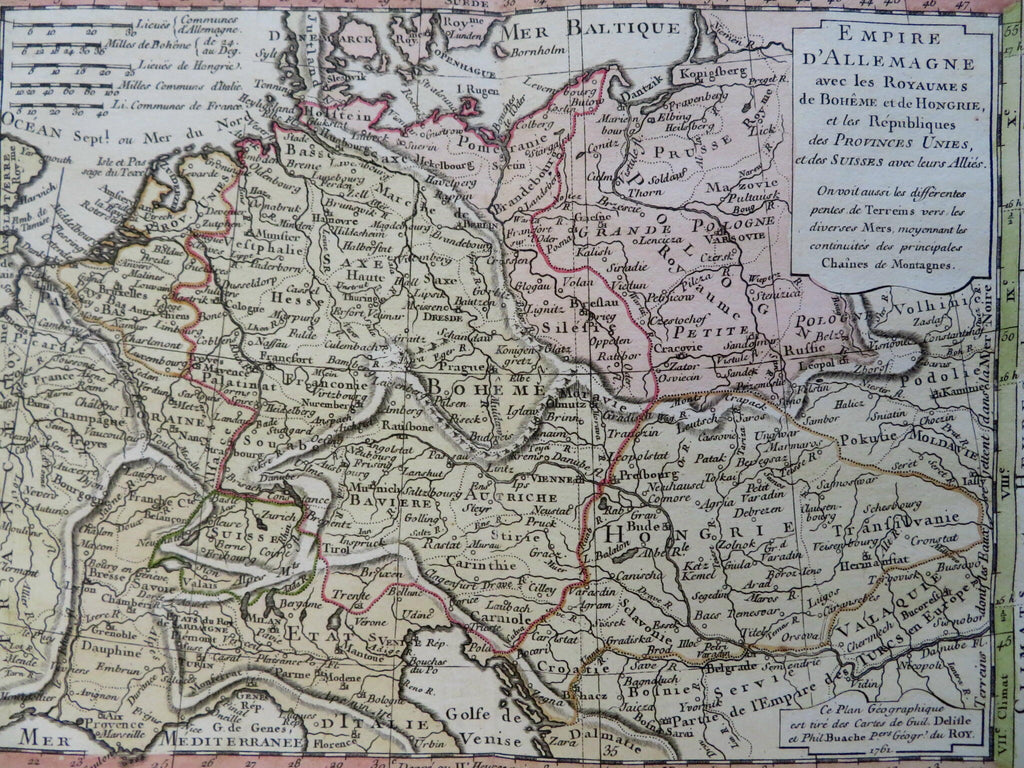
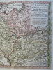
Empire D'Allemagne avec les Royaumes de Hoheme, et de Hongrie, et les Republiques des Provinces Unies et des Suisses avec leurs Allies.
(Old Maps, 18th Century Maps, Europe, Holy Roman Empire, Germany, Austria, Hungary, Bohemia, Poland, Switzerland, Low Countries, Netherlands, Belgium, United Provinces).
Issued 1761, Paris by Delisle & Buache.
Scarce mid-18th century engraved map with lovely original hand color.
Well preserved, nice looking example with pleasing age patina.
Original center fold as issued.
Sheet Measures c. 10 1/4" H x 15" W.
Engraved Area Measures c. 6 1/2" H x 8 3/4" W.
Cartographic Reference(s):
Tooley's Dictionary of Mapmakers, vol. 1.
[B15078].