Hoorn Netherlands Holland Canals Ships 1678 Guicciardini detailed city plan
Brian DiMambro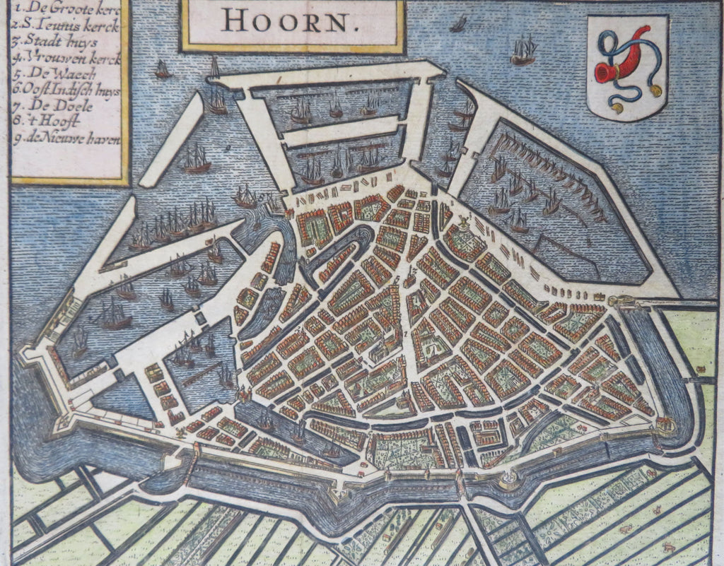


Hoorn.
(Old Maps, 17th Century Maps, Europe, Low Countries, Netherlands, Holland, Hoorn, Detailed City Plan, Canals, Ships, Military Fortifications).
Issued 1678, Amsterdam by Guicciardini. (after Blaeu).
Highly detailed late 17th century engraved city plan with lovely hand color.
A staggering level of detail is contained within this wonderful miniature city plan, including hundreds of tiny houses and specific garden plans, a short key at top identifies a handful of key locations.
Nice looking example, pleasing age patina, any minor age flaws easy to overlook or forgive.
Original fold lines as issued.
Sheet Measures c. 5 1/4" H x 6 1/4" W.
Engraved Area Measures c. 4 1/4" H x 5 1/4" W.
Cartographic Reference(s):
Tooley's Dictionary of Mapmakers, vol. 2.
Deys, Guicciardini Illustratus, Hoorn-5, p. 247.
[B12289].