Perry Expedition U.S. Japan Expedition Cape of Good Hope 1855 engraved map
Brian DiMambro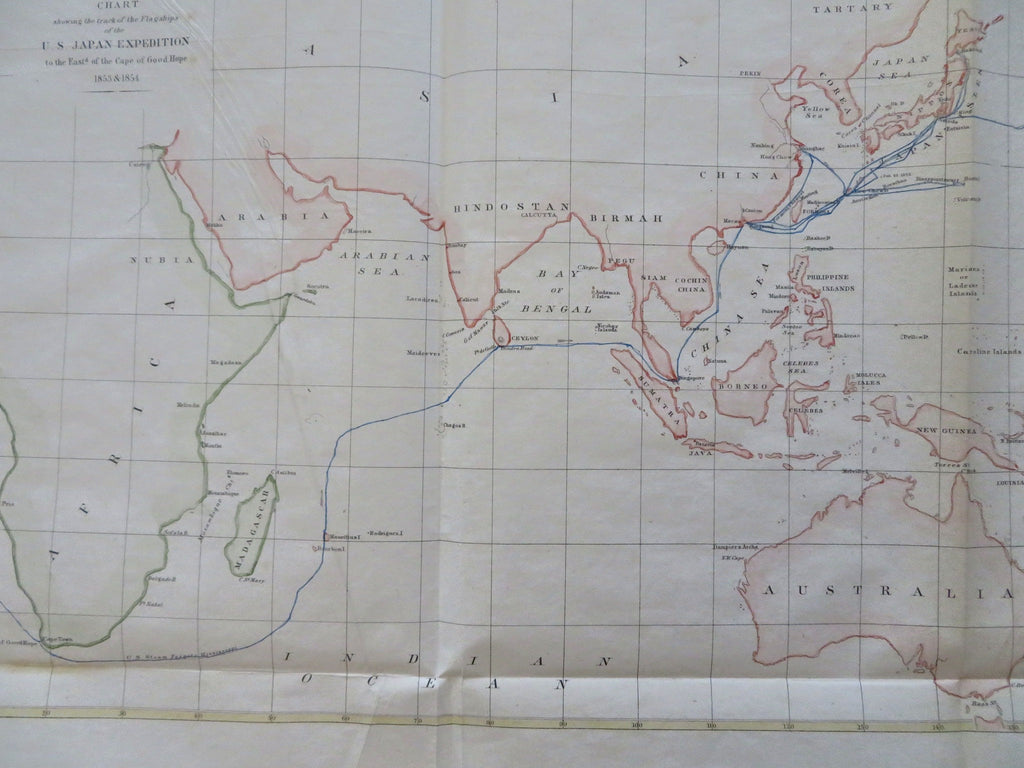
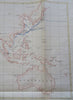

Chart Showing the Track of the Flagships of the U.S. Japan Expedition to the East of the Cape of Good Hope 1853 & 1854.
(Old Maps, 19th Century Maps, Oceania, India, Australia, Indonesia, Korea, Madagascar, Papua New Guinea).
Issued 1855, United States.
Mid 19th century lithographed map with attractive hand color.
The route of the U.S. Steam Frigate Mississippi is shown in blue across the oceans.
Remains a nice looking example with a pleasing age patina. Any age flaws mostly minor and easy to overlook or forgive.
Sheet Measures c. 12" H x 17 3/4" W.
Engraved Area Measures c. 10 1/4" H x 16 1/4" W.
[B12390].