Plymouth England Devon Citadel City Plan Docks c. 1760 engraved map
Brian DiMambro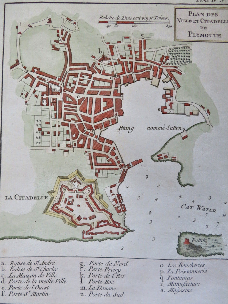


Plan des Ville et Citadelle de Plymouth.
(Old Maps, 18th Century Maps, Europe, British Isles, England, Devon, Plymouth, Citadel, Star Fort, City Plan, Docks).
Issued c. 1760, France by Bellin.
Uncommon late 18th century engraved city plan map with attractive hand color.
Remains a nice looking example with a pleasing age patina. Any age flaws mostly minor and easy to overlook or forgive.
Sheet Measures c. 13" H x 9" W.
Engraved Area Measures c. 8 1/2" H x 6 3/4" W.
Cartographic Reference(s):
Tooley's Dictionary of Mapmakers, vol. 1.
[R34161].