Zhoushan Island China Zhejiang Province Chusan c. 1749-50 Bellin hand color map
Brian DiMambro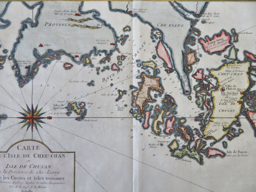
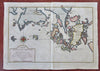
Carte de L'Isle de Cheu-Chan.
(Old Maps, 18th Century Maps, Asia, China, Zhoushan Island, Ning-po, Chusan, Cheu-Chan, Zhejiang Province).
Issued c. 1749-850, Paris by Bellin.
Mid 18th century engraved map with attractive hand color.
Remains a nice looking example with a pleasing age patina. Any age flaws mostly minor and easy to overlook or forgive.
Original center fold as issued.
Sheet Measures c. 10" H x 14" W.
Engraved Area Measures c. 8 1/4" H x 12 1/2" W.
Cartographic Reference(s):
Tooley's Dictionary of Mapmakers, vol. 1.
[R34164].