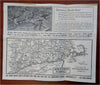
Cape Cod to NY Road Map c. 1920's Jamestown RI Ferries tourist promo brochure
Brian DiMambro- Antiquarian Books, Maps & Prints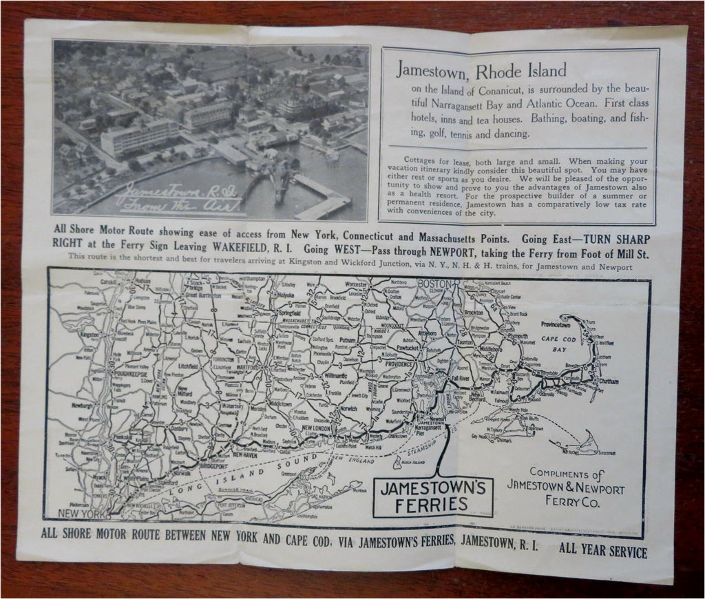
(Old Brochures, 20th Century Pamphlets, Vintage Advertising, Americana, Travel, Tourism, New England, Rhode Island, Connecticut, Massachusetts, Cape Cod).
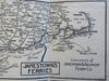
Road Map: All Shore Motor Route New York to Cape Cod via Jamestown's Ferries, Jamestown R.I.
Published likely c. 1920's-30's, Jamestown, Rhode Island by Jamestown Ferries.
Folding early 20th century brochure. Text in English.
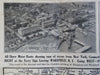
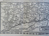
Unfolds to roadmap of coastal Massachusetts, Rhode Island, & Connecticut which emphasizes the Ferry routes. Includes aerial view of Jamestown, Rhode Island.
Publisher's pictorial paper wrappers folded into panels, printed on both sides.
Unusual combination of a Ferry water line map combined with a photographic birds-eye view.
Item is old and shows some signs of handling and time. Item is not new or in "new" condition.
Paper gently age worn, slight rubbing, remains overall clean and attractive as a fragile survival.
Paper is lightly toned, signs of handling, small scattered spotting, internally still well preserved, tight, sound.
Still attractive on the shelf. The scarce item displays a pleasing and unique age patina and overall is in nice antiquarian condition, any age flaws easy to overlook or forgive.
Please review photos for more detail and our best attempt to convey how this offering survives.
Covers measures c. 9 1/2" H x 3 7/8" W.
[B8834].