Frankfurt Germany Cartoon Pictorial Map & City Plan c. 1950's tourist brochure
Brian DiMambro- Antiquarian Books, Maps & Prints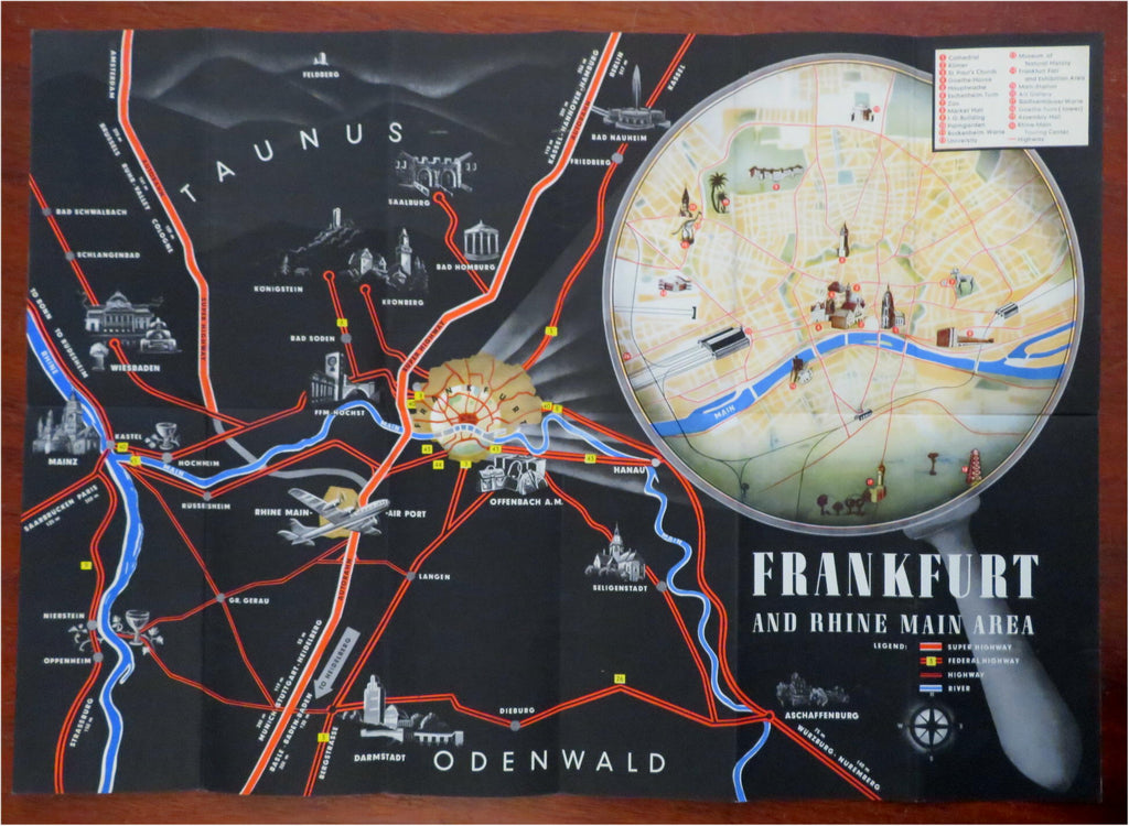


(Old Pamphlets, 20th Century Brochures, Europe, Germany, Frankfurt am Main, Travel, Tourism, aviation).
Frankfurt. (Germany).
Published c. 1935-50's, Frankfurt, Germany by K.G. Lohse.
Folding brochure. Text in English. Illustrated throughout. Unfolds to a very striking pictorial map with a city plan map of Frankfurt am Main.
Publisher's pictorial color lithographed paper wrappers folded into panels, printed on both sides.
Item is almost certainly 70+ years old and shows some signs of handling and time. Item is not new or in "new" condition.
Paper gently age worn, slight rubbing, remains overall clean and attractive as a fragile survival.
Paper is lightly toned, signs of handling, small scattered spotting, internally still well preserved, tight, sound.
Still attractive on the shelf. The scarce item displays a pleasing and unique age patina and overall is in nice antiquarian condition, any age flaws easy to overlook or forgive.
Please review photos for more detail and our best attempt to convey how this offering survives.
Covers measures c. 8 1/4" H x 4" W.
[B8838].