Biblical Travels St. Paul & Israelites Egypt Greece Anatolia 1853 Hall map
Brian DiMambro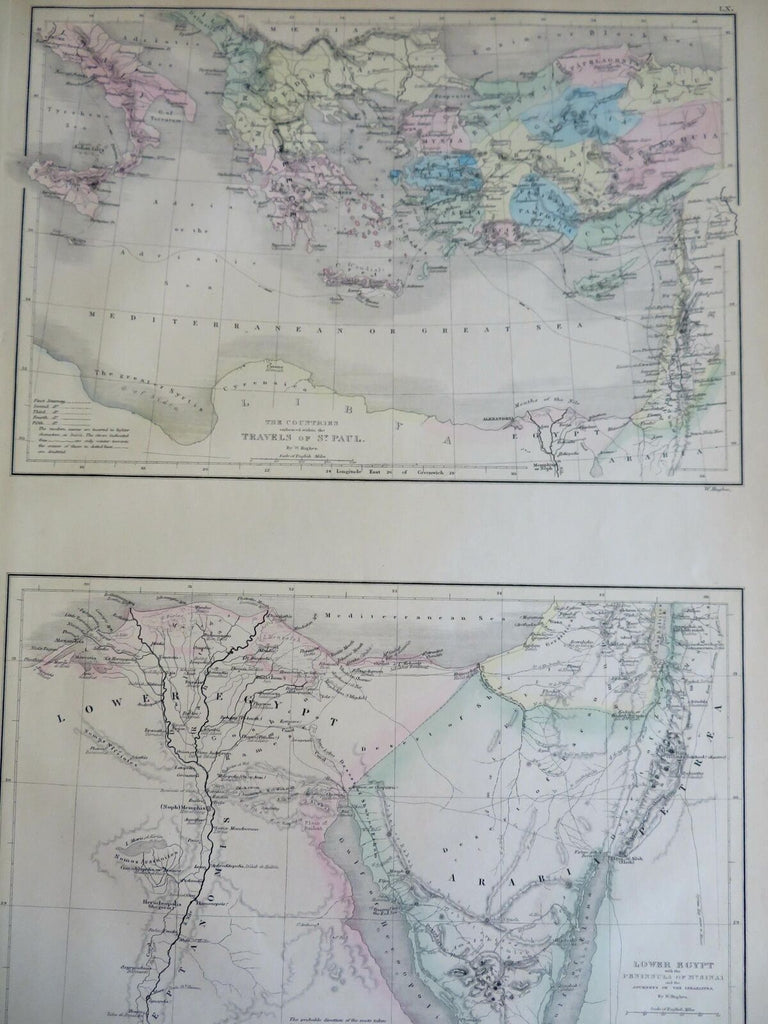


Lower Egypt with the Peninsula of Mt. Sinai and the Journeys of the Israelites - The Countries Embraced Within The Travels of St. Paul.
(Old Maps, 19th Century Maps, Africa, North Africa, Egypt, Arabia, Eastern Mediterranean, Greece, Anatolia, Cyprus).
Issued 1853, Edinburgh by A. & C. Black. Engraved by W. Hughes.
Mid 19th century engraved map with original hand color.
Well preserved, nice looking example with pleasing age patina.
Sheet Measures c. 12 1/2" H x 17" W.
Engraved Area Measures c. "H x "W.
Cartographic Reference(s):
Tooley's Dictionary of Mapmakers, vol 1.
[R30971].