Bridgeport north Pequonnock Fairfield County city plan 1893 Connecticut Hurd map
Brian DiMambro- Antiquarian Books, Maps & Prints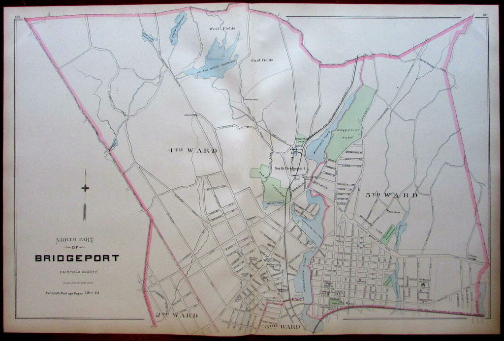
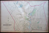

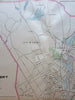
North Part of Bridgeport, Fairfield County.
(United States / New England / Connecticut / City Plan / Pequonnock River / Berkshire Mill Pond / Bunnell's Pond / Island Brook Reservoir).
Issued 1893, Boston by D. H. Hurd & Co.
Large late-19th century lithographed city plan with original hand color. Shows town borders, terrain features, roads, rail lines, wards, parks, and many specific buildings with owner/business names which can be examined in detail in the provided photographs.
Sheet Measures c. 19 1/2"H x 29 1/2"W.
Printed Area Measures c. 19 1/2"H x 28"W.
Centerfold as issued.
Cartographic Reference(s):
Tooley's Dictionary of Mapmakers, vol. 2, pp. 397.
LeGear's United States Atlases in LoC, L545.
[R19660].