Canada West Great Lakes Ontario Lake Erie Toronto Ottawa 1860 Mitchell map
Brian DiMambro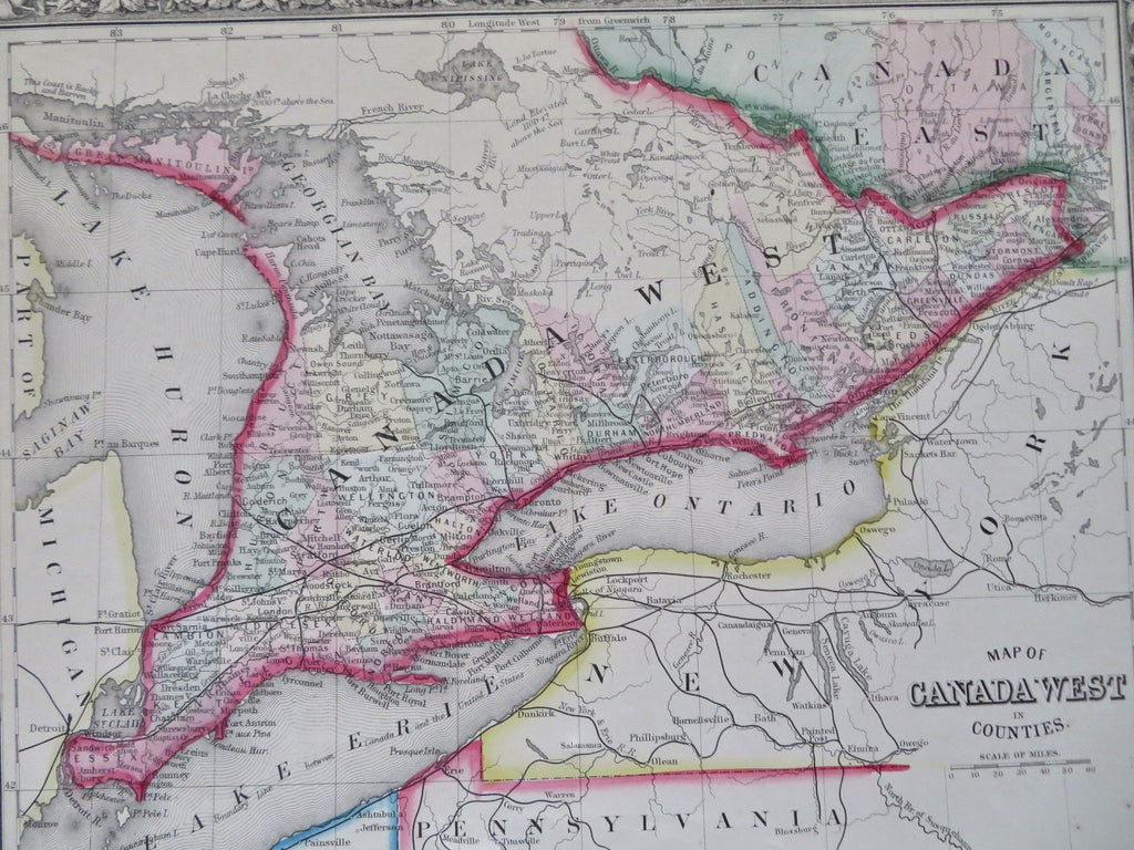
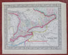
Map of Canada West in Counties.
(Old Maps, 19th Century Maps, North America, Canada, Ontario, Toronto, Ottawa, Niagara Falls, Lake Erie, Lake Ontario, Georgian Bay).
Issued c.1860, Philadelphia by S. Augustus Mitchell.
There are many variant issues of this map, with differing borders and interior details. A comparison with other Mitchell maps of the 1860's-80's era will reveal this on close inspection.
Mid 19th century antique engraved map with original hand color. Decorative border greatly enhances visual appeal.
Well preserved, nice looking example with pleasing age patina.
Sheet Measures c. 12 1/2" H x 15" W.
Engraved Area Measures c. 10 1/2" H x 14" W.
Cartographic Reference(s):
Tooley's Dictionary of Mapmakers, vol. 3.
[R32426].