Canadian Maritimes New Brunswick Newfoundland 1889-93 Bradley folio map
Brian DiMambro- Antiquarian Books, Maps & Prints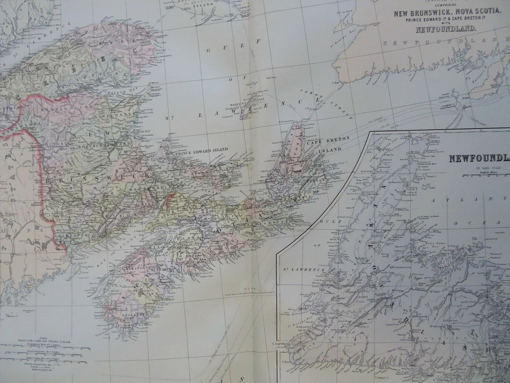

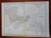
Dominion of Canada (Eastern Sheet) Containing New Brunswick, Nova Scotia, Prince Edward Island & Cape Breton Island with Newfoundland.
(Old Maps, 19th Century Maps, North America, Canada, Maritimes, Newfoundland, Nova Scotia, New Brunswick, Quebec, Prince Edward Island, Cape Breton Island).
Issued c. 1889-93, Philadelphia by Bradley.
Well detailed late 19th century oversized folio sheet color lithographed folio map with lovely original hand color.
A remarkable level of detail shown within Newfoundland.
Original center fold as issued. Light old damp staining in wide blank margins, small minor light stain at bottom of centerfold, printed area otherwise very clean.
Sheet Measures c. 26" H x 19" W.
Printed Area Measures c. 22" H x 18" W.
Cartographic Reference(s):
Tooley's Dictionary of Mapmakers, vol. 1.
[R30603].