Canadian Maritimes Newfoundland Nova Scotia New Brunswick 1873 Williams map
Brian DiMambro- Antiquarian Books, Maps & Prints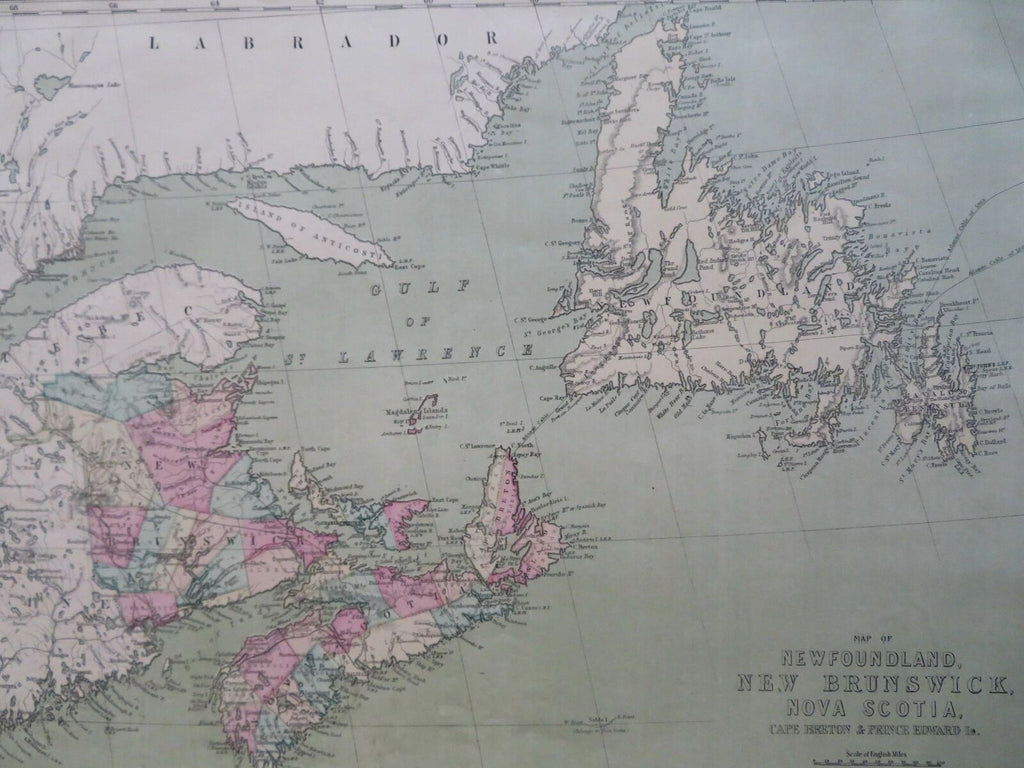


Map of Newfoundland, New Brunswick, Nova Scotia, Cape Breton & Prince Edward Is.
(Old Maps, 19th Century Maps, North America, Canada, Maritimes, Newfoundland, New Brunswick, Nova Scotia, Cape Breton Island, Prince Edward Island).
Issued 1873, New York by J. David Williams.
Late 19th century lithographed map with lovely original hand color.
Large format and unique colors help make this map visually distinctive and of interest to collectors for the details or for display.
Sheet Measures c. 14" H x 19 1/2" W.
Printed Area Measures c. 12" H x 17" W.
Cartographic Reference(s):
Tooley's Dictionary of Mapmakers, vol. 4.
[R30463].