Chile Argentine Republic Rio de la Plata Buenos Aires 1850 Cowperthwait map
Brian DiMambro- Antiquarian Books, Maps & Prints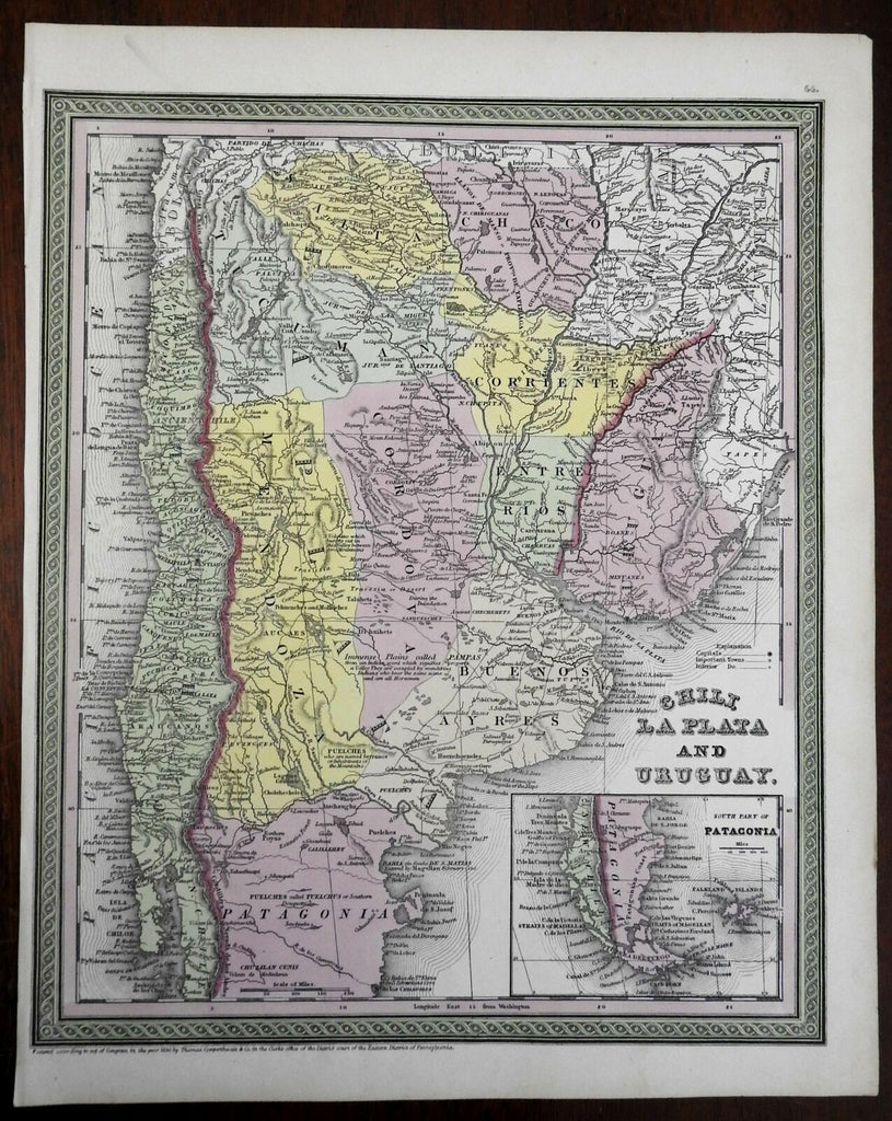

Chile, La Plata, and Uruguay.
(South America, Chile, Argentina, Uruguay, Patagonia, Buenos Aires, Rio de la Plata).
Issued c.1850, Philadelphia by Cowperthwait.
Fine mid-19th century engraved map with original hand color. Cowperthwait maps of this mid-century era were issued with a range of color as well as variant decorative borders.
Inset map of the southern part of South America.
Nice looking example, pleasing age patina, nice clean example.
Sheet Measures c. 15 1/4" H x 12 1/2" W.
Engraved Area Measures c. 13 1/2" H x 10 1/2" W.
Cartographic Reference(s):
Reps, American Maps and Mapmakers, p. 313.
Tooley's Dictionary of Mapmakers, vol. 4, pp. 260.
[R23404].