Comparative chart countries British empires United States 1835 Bradford print
Brian DiMambro- Antiquarian Books, Maps & Prints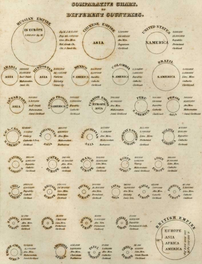
Comparative chart, of different countries. [Showing area, population, etc.].
(Early American Cartography, chart, Russian Empire, Europe, Asia, Chinese Empire, United States, North America, South America, Brazil, Mexico, British Empire, Turkish Empire, Arabia, Prussia, Japan, Empire of Morocco, ).
Issued 1835, Boston by Bradford for his "Atlas of Universal Geography".
An increasingly uncommon early 19th century American produced and engraved print. Compares nations of the world by circle size.
Bradford prints of this decade are characterized by an almost primitive engraving style, unique to this era of cartographic production in America.
Nice looking example, light old damp staining to sheet which is easy to miss, overlook or forgive visually, pleasing age patina, any minor age flaws easy to overlook or forgive.
Sheet Measures c. 9 3/4" H x 12 3/4" W.
Engraved Area Measures c. 7 3/4" H x 9 3/4" W.
Cartographic Reference(s):
Reps, American Maps and Mapmakers, pp. 270-71.
Tooley's Dictionary of Mapmakers, vol. 1.
[R21729].