Constantinople Ottoman Empire Turkey Istanbul Sea of Marmara 1840 miniature map
Brian DiMambro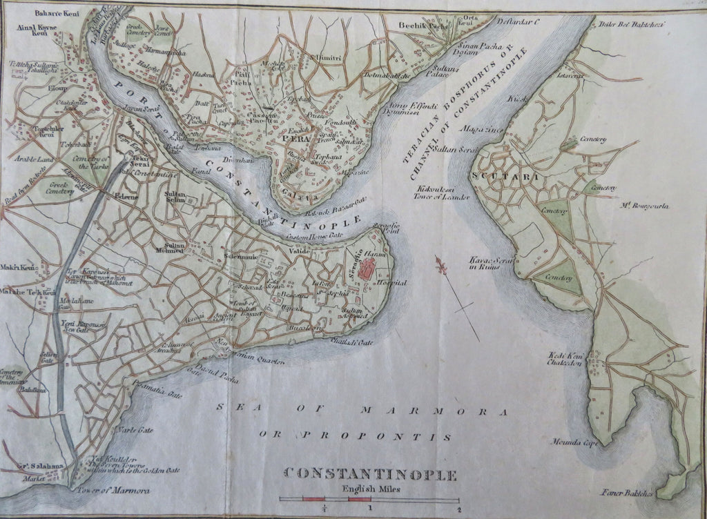


Constantinople.
(Old Maps, 19th Century Maps, Europe, Ottoman Empire, Constantinople, Istanbul, City Plan, Golden Horn, Sea of Marmara).
Issued 1840, New York by J. & J. Harper.
Mid 19th century engraved city plan with attractive hand color.
Remains a nice looking example with a pleasing age patina. Any age flaws mostly minor and easy to overlook or forgive.
Original fold lines as issued.
Sheet Measures c. 6" H x 7 1/2" W.
Engraved Area Measures c. 5" H x 6 1/2" W.
Cartographic Reference(s):
Tooley's Dictionary of Mapmakers, vol. 2.
[B12404].