Eastern China detailed coastal survey Qing Empire Nanjing 1860-70 Weller map
Brian DiMambro- Antiquarian Books, Maps & Prints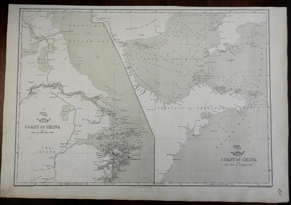
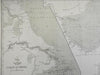
Coast of China from Nyew-Tew to Haw-Chow.
(Asia, China, Qing Empire, Chinese Coast, Hang-Chow, Nanjing, Yangtze River, Yellow River, Local Map)
Issued c. 1856-72, London by E. Weller for Weekly Dispatch.
Fine and historically interesting antique lithographed map. "Yellow Sea" so named.
Extensive sounding depths along the shoreline. Small pictorial angel and globe above title.
Sheet Measures c. 19" W x 13" H.
Printed Area Measures c. 17" W x 12" H.
Cartographic Reference(s):
Tooley's Dictionary of Mapmakers, vol. 4.
[PL14 - R2896].