Flanders Ath Ypres Bruges 1708 decorative rare de la Feuille map w/ city plans
Brian DiMambro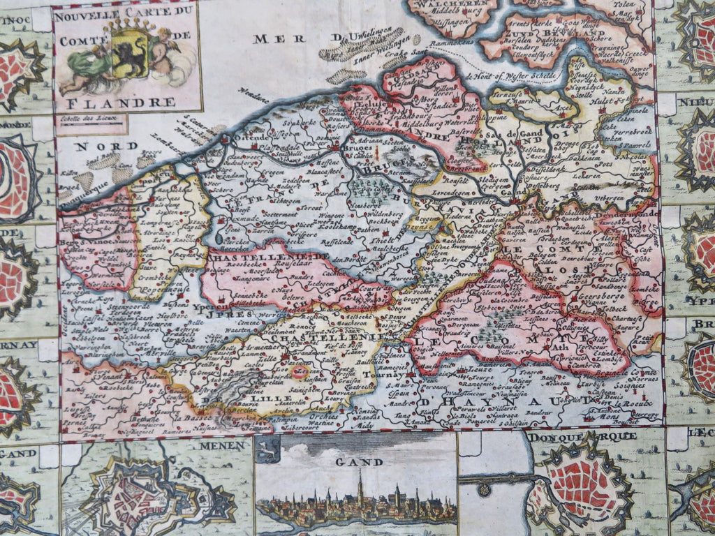
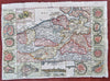
Nouvelle Carte de Flandre.
(Old Maps, 18th Century Maps, Europe, Low Countries, Netherlands, Belgium, Flanders, Gand, Ostende, Dunkirk, Ath, Ypres, Bruges).
Issued 1708, Amsterdam by de La Feuille.
Scarce early 18th century engraved map with attractive hand color. Twenty flags of various European states surrounding the map, a pictorial vignette title top right depicts a river god. Superior visual example, a great map.
Remains a nice looking example with a pleasing age patina. Any age flaws mostly minor and easy to overlook or forgive.
Original fold lines as issued, map was neatly affixed long ago to an old paper backing sheet.
Sheet Measures c. 7 3/4" H x 10 1/4" W.
Engraved Area Measures c. 6 1/4" H x 8 1/2" W.
Cartographic Reference(s):
Tooley's Dictionary of Mapmakers, vol. 1.
[R32249].