Martinique French Colony Caribbean Island Josephine 1850 Villerey decorative map
Brian DiMambro- Antiquarian Books, Maps & Prints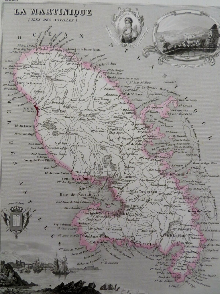
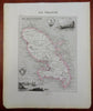
La Martinique.
(Old Maps, 19th Century Maps, Caribbean Sea, Martinique, French Colony, St. Pierre, Coat of Arms, Empress Josephine).
Issued 1850, Paris. Engraved by Villerey.
Mid 19th century engraved map with original hand color.
Remains a nice looking example with a pleasing age patina. Any age flaws mostly minor and easy to overlook or forgive.
Sheet Measures c. 10 1/4" H x 12 1/4" W.
Engraved Area Measures c. 7" H x 9" W.
Cartographic Reference(s):
Tooley's Dictionary of Mapmakers, vol. 1.
[R30224].