Mexico Texas as Republic shape Gold Region United States 1859 Boynton mini map
Brian DiMambro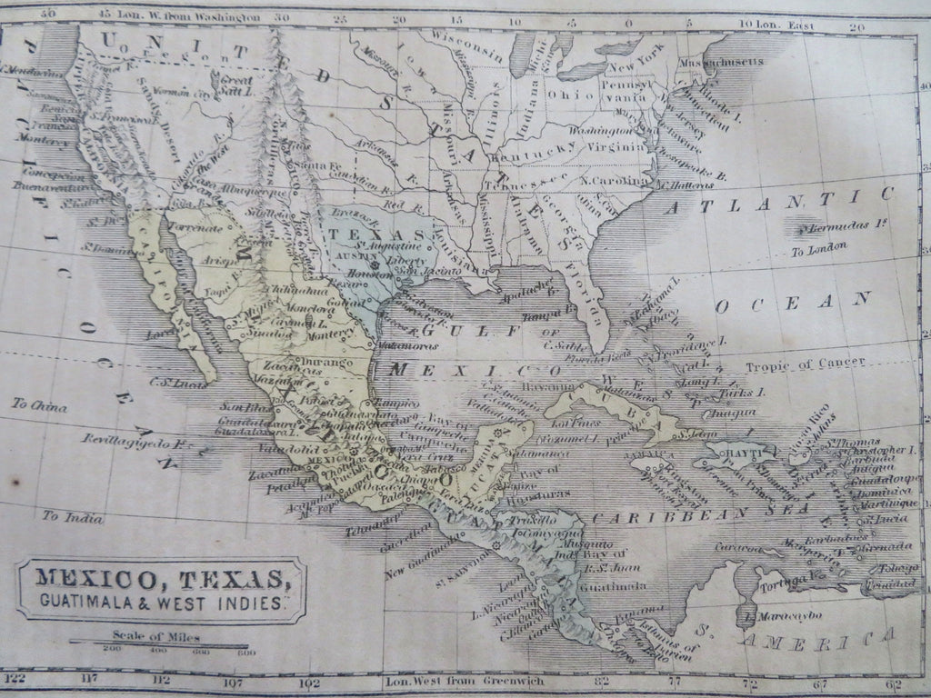
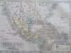
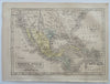
Mexico, Texas, Guatimala & West Indies.
(Old Maps, 19th Century Maps, Americana, United States, Mexico, Texas, Central America, Caribbean, Cuba, Jamaica, Puerto Rico, Haiti, Dominican Republic).
Issued 1859, Boston. Engraved by Boynton
Mid 19th century miniature engraved map with original hand color.
The map is a re-used plate from the 1830's which still shows Texas in a form which appears to be pre-statehood (Republic) without the stove-pipe at the top. "Mormon City" is named thus along the Great Salt Lake."Gold Region" named within California.
Well preserved, nice looking example with pleasing age patina.
Sheet Measures c. 7 1/2" H x 5 1/2" W.
Engraved Area Measures c. 6 1/4" H x 4 1/2" W.
Cartographic Reference(s):
Tooley's Dictionary of Mapmakers, vol. 1.
[R32802].