Mughal Empire India Delhi Agra Calcutta 1796 Doolittle early American map
Brian DiMambro- Antiquarian Books, Maps & Prints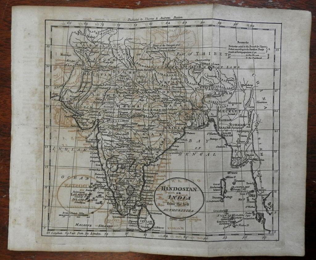
Hindostan or India from the Best Authorities.
(Asia, India, Mughal Empire, Ceylon, Sri Lanka, Maldives, Mysore, Madras, Gujurat, Hyderabad, Calcutta, Bombay, Agra, Delhi, Punjab).
Issued 1796, Boston by Thomas & Andrews. Engraved by Doolittle.
Late 18th century engraved map. An example of early American cartographic engraving which is inherently uncommon/scare due to the pre-1800 date.
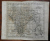
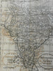
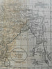
Map displays signs of age, including: visible offsetting, scattered spotting, and short archival tape repairs on the reverse to close splits at fold line ends (please see photos). Despite the condition issues as described and seen, map retains a pleasing if not noble appearance, unique to printed maps of this era.
Original fold lines as issued.
Please examine all images closely. We have done our best to fully illustrate the condition of the map so there are no surprises when it arrives.
Sheet measures c. 8 1/4" H x 9 1/2" W.
Engraved area measures c. 7 1/2" H x 8 3/8" W.
Cartographic Reference(s):
Wheat & Brun, Maps Published in America Before 1800, 886.
Tooley's Dictionary of Mapmakers, vol. 1.
[R25905].