Mughal Empire India Ganges & Indus Rivers 1599 Ruscelli Rosaccio Ptolemy map
Brian DiMambro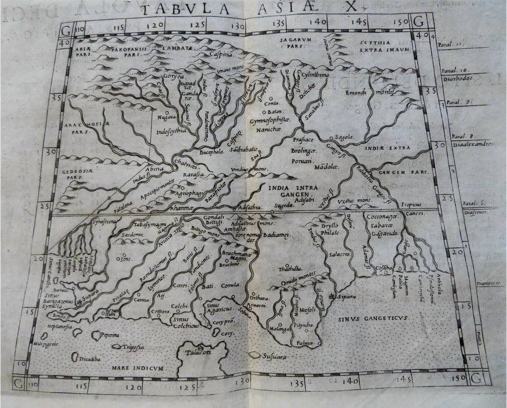
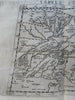
Tabula Asiae X.
(Old Maps, 16th Century Maps, Asia, Mughal Empire, India, Ganges, Indus, Ptolemaic Geography).
Issued Venice, [1582] 1599 by Giovanni Lorenzo D'Anania / Ruscelli & Rosaccio. Printed by heirs of Melchoir Sessa. Fourth Edition, second issue using the re-engraved 1582 plate in 1598-99. Italian text on verso.
This scarce late issue used the 1561 plate (a close examination of minute details reveals this), but the plate was not used again after this 1599 printing and this map has no further appearances or printings.
Nice looking example, pleasing age patina, any minor age flaws easy to overlook or forgive.
Original fold line as issued.
Sheet measures c. 13" x 9 1/4".
Engraved area measures c. 9 1/4" x 7 1/4".
Cartographic Reference(s):.
Tooley's Dictionary of Mapmakers , v. 4., p. 87.
Shirley, Maps in Atlases in British Library , T.PTOL-10f
Phillips, Atlases In the Library of Congress , 409.
Sabin, Dictionary Books Relating to America , 66507.
[R31090].