New Zealand Mercury Bay Tolaga Bay 1774 Capt. Cook & Hawkesworth harbor map
Brian DiMambro- Antiquarian Books, Maps & Prints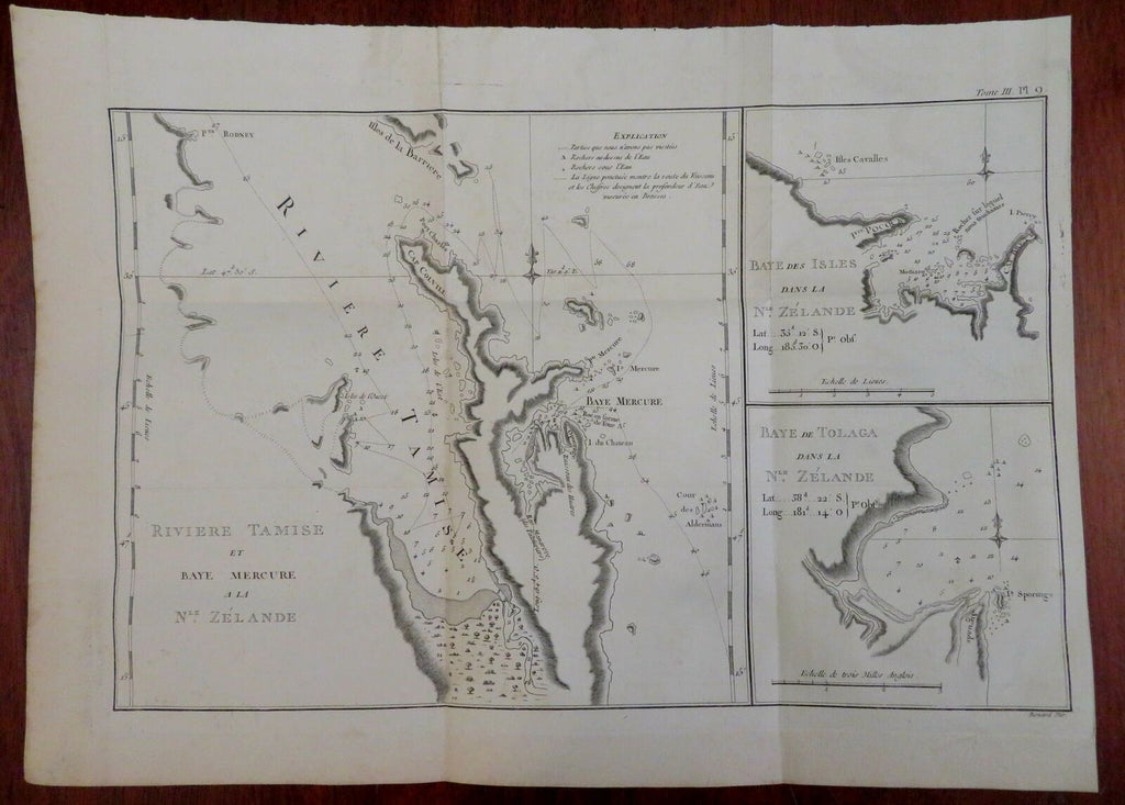
Riviere Tamise et Baye Mercure a la Nle. Zelande - Baye des Isles dans la Nle. Zelande - Baye de Tolaga Dans La Nle. Zelande.
(Old Maps, 18th Century Maps, Oceania, New Zealand, Mercury Bay, Tolaga Bay, Bay des Isles).
Issued 1774, Paris by Hawkesworth. Map by Benard.
Fine and uncommon 18th century engraved map based on the voyages of Capt. Cook. The three harbors all have extensive sounding depths, ship tracks, anchorage locations and some shoreline interior terrain.
Nice looking example, pleasing age patina, any minor age flaws easy to overlook or forgive.
Original fold lines as issued.
Sheet measures c. 13 1/2" H x 18 1/4" W.
Engraved area measures c. 11" H x 16 3/4" W.
Cartographic Reference(s):.
Tooley's Dictionary of Mapmakers, vol. 2.
[R29229].