Province of Ontario Canada Toronto St. Lawrence 1875 Walling & Tackabury map
Brian DiMambro- Antiquarian Books, Maps & Prints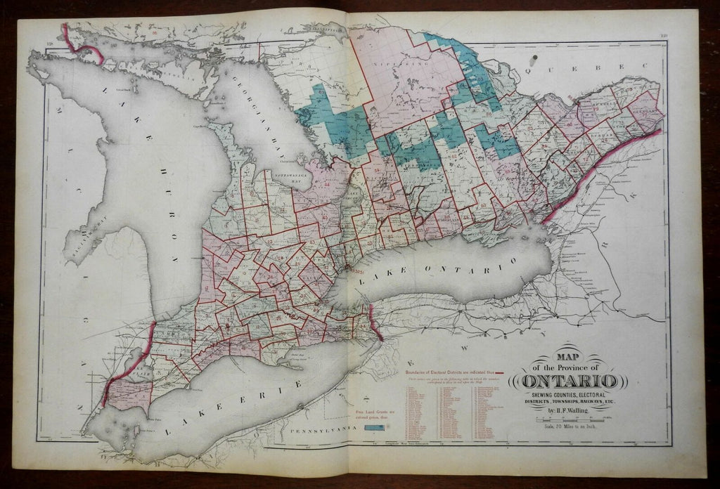

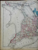
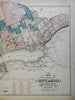
Map of the Province of Ontario, Shewing Counties, Electoral Districts, Great Lakes, Lake Huron, Erie, Ontario, Georgian Bay, townships, Railways, Etc.
(North America, Canada, Ontario, Toronto, Lake Erie, Lake Ontario, Georgian Bay, Lake Simcoe).
Issued 1875, Montreal by Tackabury. Map by H.F. Walling.
Scarce late 19th century lithographed map with original hand color as well as some color lithographic printing. Overprinted in red to show the Boundaries of Electoral Districts, of which 88 are named in three columns.
Well preserved, nice looking example with pleasing age patina.
Original center fold as issued.
Sheet Measures c. 17 1/2" H x 26 1/2" W.
Printed Area Measures c. 15" H x 26" W.
Cartographic Reference(s):
Tooley's Dictionary of Mapmakers, vol. 4.
[R25526].