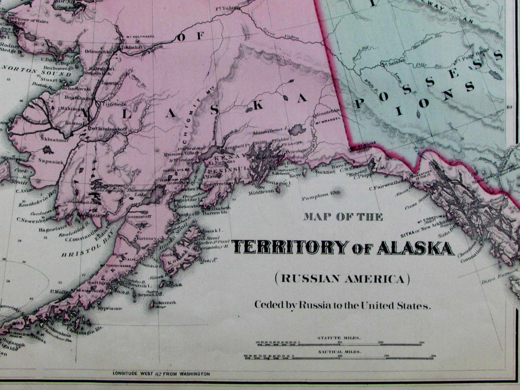
Russian Alaska America Territory Seward's ceded by Russians 1877 old OW Gray map
Brian DiMambro- Antiquarian Books, Maps & Prints


Map of the Territory of Alaska
(Russian America)
Ceded by Russia to the United States
Issued Philadelphia, 1876-7 by O.W. Gray & Son.
Lovely antique engraved and lithographed transitional map, with original hand color.
Captures the state at a fascinating point in its history, less than 10 years after its purchase by the United States from Russia and while still formally a Territory. British Possessions to the right where is today Canada.
Many oceanic sounding depths, interior topographical terrain shown via hatchure. We observe a Russian Factory named on one of the small islands above the Aleutian chain, an English factory named lower right above Queen Charlotte island. Longitude given from Washington, D.C.
Minor light toning and small scattered age spotting as typical for maps of this vintage, light old edge damp staining in blank margins, perhaps small minor paper flaws, but to our eyes and for most people, an entirely acceptable and nice looking example of this antique map.
Sheet measures c. 14 1/4" x 17"
Printed area measures c. 11 3/4" x 14 3/4".
[R12947].
Hayes, Maps of Exploration and Discovery- Pacific Northwest , p. 168. (Purchase of Alaska).
Tooley's Dictionary of Mapmakers, v. 2, p. 206.
