Russian Empire in Europe Finland Poland Ukraine Baltic States 1895 large hc map
Brian DiMambro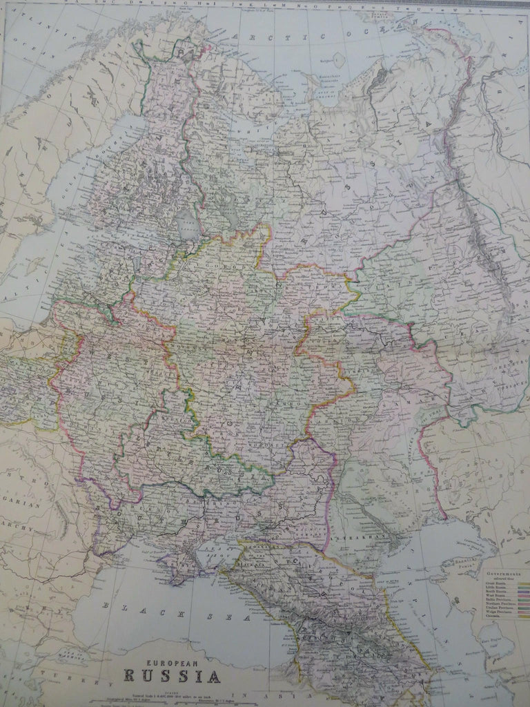

European Russia.
(Old Maps, 19th Century Maps, Europe, Russian Empire, Finland, Russia, Baltic States, Poland, Ukraine, Crimea, Moscow, St. Petersburg, Kyiv, Warsaw, Astrakhan).
Issued 1895, Philadelphia by M. Bradley & Bros.
Large oversize late 19th century map with original hand color.
Well preserved, nice looking clean example with pleasing age patina.
Original center fold as issued.
Sheet Measures c. 18 3/4" H x 25 14/2" W.
Printed Area Measures c. 15 1/2" H x 20" W.
Cartographic Reference(s):
Tooley's Dictionary of Mapmakers, vol. 1.
[R32007].