South Australia Gladstone Palmerstone High Table Land 1893 Stanford map
Brian DiMambro- Antiquarian Books, Maps & Prints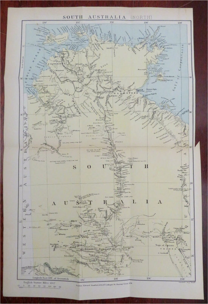
South Australia (North).
(Oceania, Australia, South Australia, Palmerston, Gladstone, High Table Land, Stuart Plains).
Issued 1893, London by Edward Stanford.
Uncommon late 19th century lithographed map with original hand color.
Original fold lines as issued. A very detailed and interesting non-atlas map which shows various names and dates with conjectural land features.
Sheet Measures c. 14 1/2" H x 9 5/8" W.
Printed Area Measures c. 13" H x 8 1/2" W.
Cartographic Reference(s):
Tooley's Dictionary of Mapmakers, vol. 4.
[R27273].