Southern India Hyperdbad Ceylon Birman Empire c.1815 Smith large detailed map
Brian DiMambro- Antiquarian Books, Maps & Prints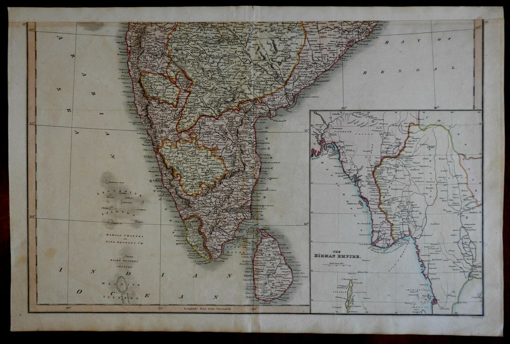


The Birman Empire.
(Asia, India, Burmah, Myanmar, India, Bangladesh, Ceylon, Sri Lanka, Andaman Islands, Pegue, Anam, China border, Rangooon, Yangon, Rangon).
Issued London, c. 1815-26 by Charles Smith. Engraved by Pickett.
Scarce early 19th century antique map, engraved with pleasing original hand color heightened in outline.
Unusual feature is a large inset lower right of the Birman Empire (modern day Myanmar- Rangon).
Overall just light wear, small age imperfections, spots and toning as typical, overall a nice looking example.
Original fold line as issued, centerfold perfectly laid down to inset tab on reverse, excellent visual appeal.
Sheet measures c. 24" x 15 1/2".
Engraved area measures c. 22 1/2" x 13 3/4".
Tooley's Dictionary of Mapmakers , vol. IV, pg. 174.
[R21122].