Texas Indian Territory Louisiana Mississippi c. 1850 Chapman & Hall engraved map
Brian DiMambro- Antiquarian Books, Maps & Prints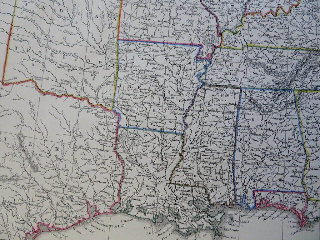


United States.
(Old Maps, 19th Century Maps, North America, United States, Texas, Louisiana, Arkansas, Indian Territory, Mississippi, Alabama, Missouri, Tennessee).
Issued c. 1850, London by Chapman and Hall.
Mid 19th century engraved map with original outline hand color.
Depicts a large portion of Texas and virtually all of Indian Territory as it then existed.
Well preserved, nice looking example with pleasing age patina.
Sheet Measures c. 9 3/4" H x 12 1/4" W.
Engraved Area Measures c. 8 1/2" H x 11" W.
Cartographic Reference(s):
Tooley's Dictionary of Mapmakers, vol. 1.
[R29499].