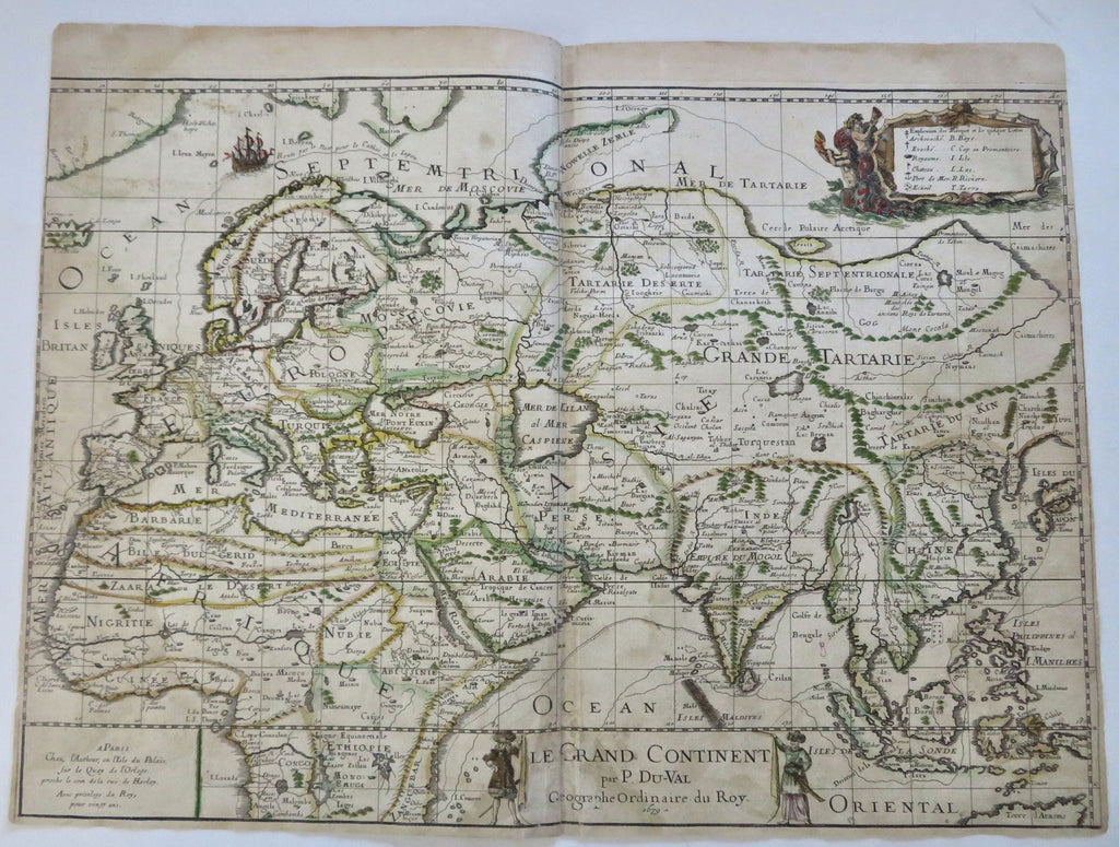
Western Hemisphere Africa Europe Asia India China 1679 DuVal rare folio map
Brian DiMambro


Le Grand Continent par P DuVal Geographe Ordinaire du Roy.
(Africa- India- Arabia- Middle East- Persia- China- East Indies- Japan)
Issued 1679, Paris by P. DuVal. Issued as part of a now very rare four-sheet wall map, this sheet offered alone. Any and all sheets are scarce in the market as are most folio sheet DuVal maps of this era.
Attractive, fascinating and rare 17th century folio sheet map, with original outline hand color.
Of particular interest for the depiction of Africa as well as India and Asian regions eastward. Title bottom center with natives of the region holding it either side, decorative cartouche around key top right. Great Wall of China shown ending at border of Korea.
As noted by Shirley, the map was issued separately and was rendered in such a way as allowing the top portion with title to be trimmed off so the sheets could all be joined. A full example is shown in Shirley's Mapping of the World, 489.
Some small old paper repairs on reverse, some damp staining, spots of color offset, paper slightly soft along edges, side blank margins trimmed down to or slightly within neat lines, etc. Rare enough that allowances must be made for any example in any condition.
Original center fold as issued.
Sheet measures c. 17 1/8" x 23 1/8".
Printed area measures c. 16" x 22 3/4".
Shirley, Mapping of the World, 489 (noting it was also published separately).
Tooley's Dictionary of Mapmakers, v. 1, p.406.
[R35337].
