World Map in double hemispheres 1807 Barlow engraved hand color map
Brian DiMambro- Antiquarian Books, Maps & Prints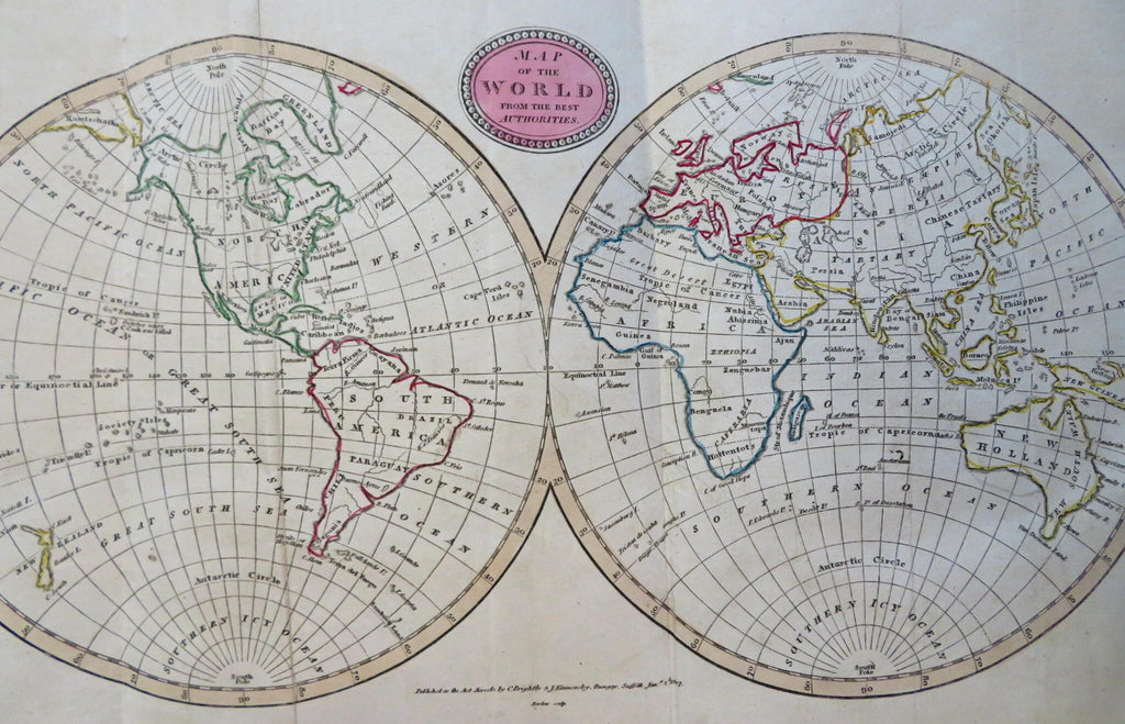
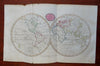
Map of the World from the Best Authorities.
(Old Maps, 19th Century Maps, World Map, Western Hemisphere, Eastern Hemisphere, Oceania, New Zealand, North America, South America, Africa, Europe, Asia, Australia).
Issued 1807, Bungay, England by C. Brightly & E. Kennersly. Engraved by E. Barlow.
Early 19th century engraved map with original outline hand color.
Van Diemens Island shown as attached to the continent of Australia.
Well preserved, tiny split at bottom of left fold line, nice looking example with pleasing age patina.
Original fold lines as issued.
Sheet Measures c. 8" H x 15 1/2" W.
Engraved Area Measures c. 7 1/4" H x 13 1/2" W.
Cartographic Reference(s):
Tooley's Dictionary of Mapmakers, vol. 1.
[R31859].