World map double Hemispheres Polar Projections World Rivers 1869 decorative map
Brian DiMambro- Antiquarian Books, Maps & Prints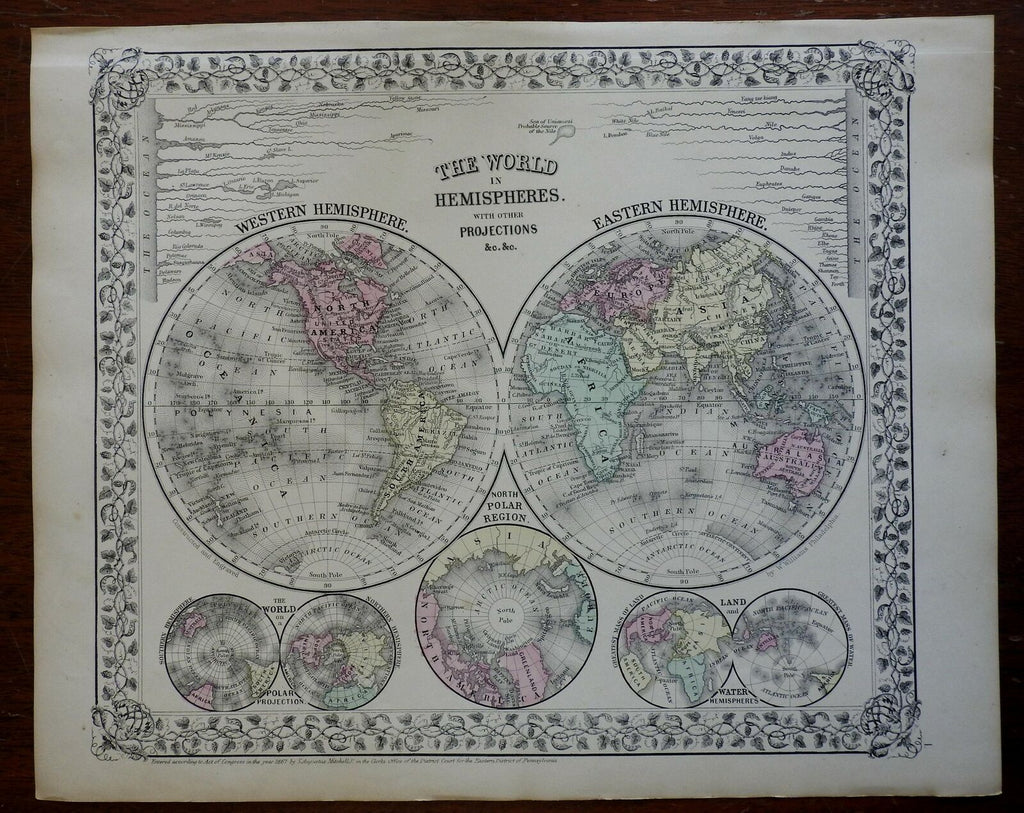
The World in Hemispheres, with Other Projections.
(North America, South America, Africa, Europe, Asia, Australia, Polar Regions, Hemispheres, Rivers of the World).
Issued c. 1867-9, Philadelphia by S.A. Mitchell.
Attractive mid-19th century engraved and lithographed map, with original hand color.
Mitchell maps of this mid-century era were issued with a range of color as well as variant decorative borders such as the grape cluster and vine framing.
Nice looking example, sheet gently uniformly age toned, pleasing subtle [mellow] age patina, any minor age flaws easy to overlook or forgive.
Sheet Measures c. 12 1/2" H x 15 1/4" W.
Engraved Area Measures c. 10 1/2" H x 13 1/2" W.
Cartographic Reference(s):
Reps, American Maps and Mapmakers, p. 313.
Tooley's Dictionary of Mapmakers, vol. 4, pp. 260.
[R25784].