World Map Eastern & Western Hemispheres 1830 Starling miniature map
Brian DiMambro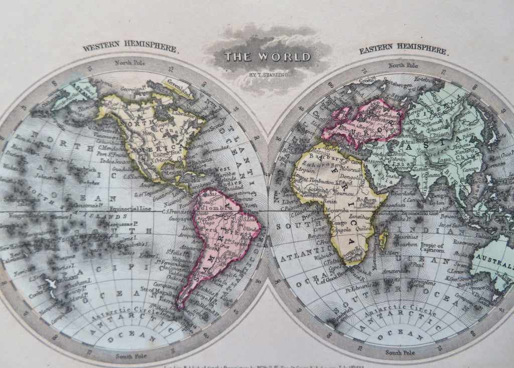
The World.
(Old Maps, 19th Century Maps, World Map, Eastern Hemisphere, Western Hemisphere, Atlantic Ocean, Pacific Ocean).
Issued 1830, London by Bull. Printed by Perkins & Bacon for Starling.
Charming little early 19th century engraved miniature map with attractive original hand color.
Remains a clean, fresh, nice looking example with a pleasing age patina.
Sheet Measures c. 4 1/4" H x 6 1/2" W.
Engraved Area Measures c. 3 1/2" H x 5 1/2" W.
Cartographic Reference(s):
Tooley's Dictionary of Mapmakers, vol. 1.
[R32291].