Zealand Holland Netherlands Low Countries fortified cities 1760 Bellin map
Brian DiMambro- Antiquarian Books, Maps & Prints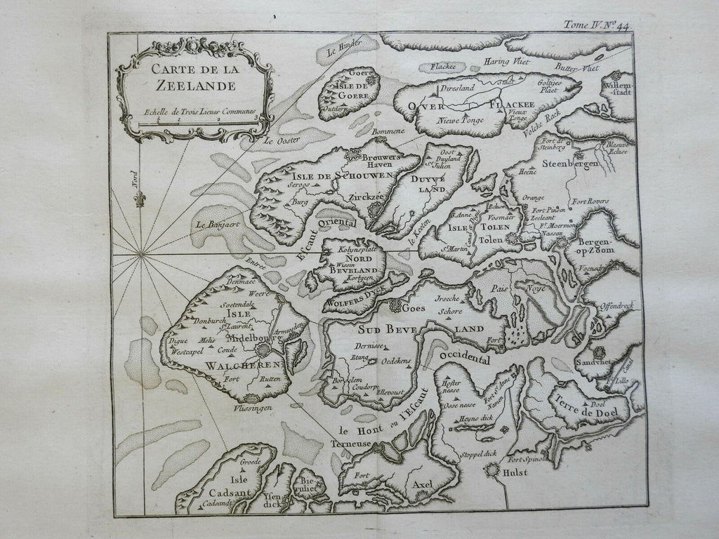
Carte de la Zeelande.
(Europe, Low Counties, Netherlands, Holland, Zealand, Fortified City).
Issued 1760, Paris by Bellin.
Mid 18th century engraved map with a pleasing, strong impression.
Nice looking example, pleasing age patina, any minor age flaws easy to overlook or forgive.
Original centerfold as issued.
Sheet measures c. 12 3/4" H x 18 1/2" W.
Engraved area measures c. 9" H x 10" W.
Cartographic Reference(s):.
Tooley's Dictionary of Mapmakers, vol.1.
[R23068].