Belfast North Ireland United Kingdom 1881 Edward Weller detailed hand color map
Brian DiMambro- Antiquarian Books, Maps & Prints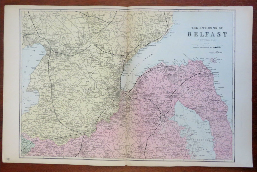
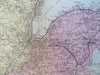
The Environs of Belfast.
(Old Maps, 19th Century Maps, British Isles, United Kingdom, North Ireland, Belfast).
Issued 1881, London by Bacon & Weller. Map by Edward Weller.
Late 19th century engraved map with original hand color.
Well preserved, nice looking example with pleasing age patina.
Original centerfold as issued.
Sheet Measures c. 13 1/2" H x 21" W.
Engraved Area Measures c. 12 1/2" H x 18 1/2" W.
Cartographic Reference(s):
Tooley's Dictionary of Mapmakers, vol. 4.
[R28010].